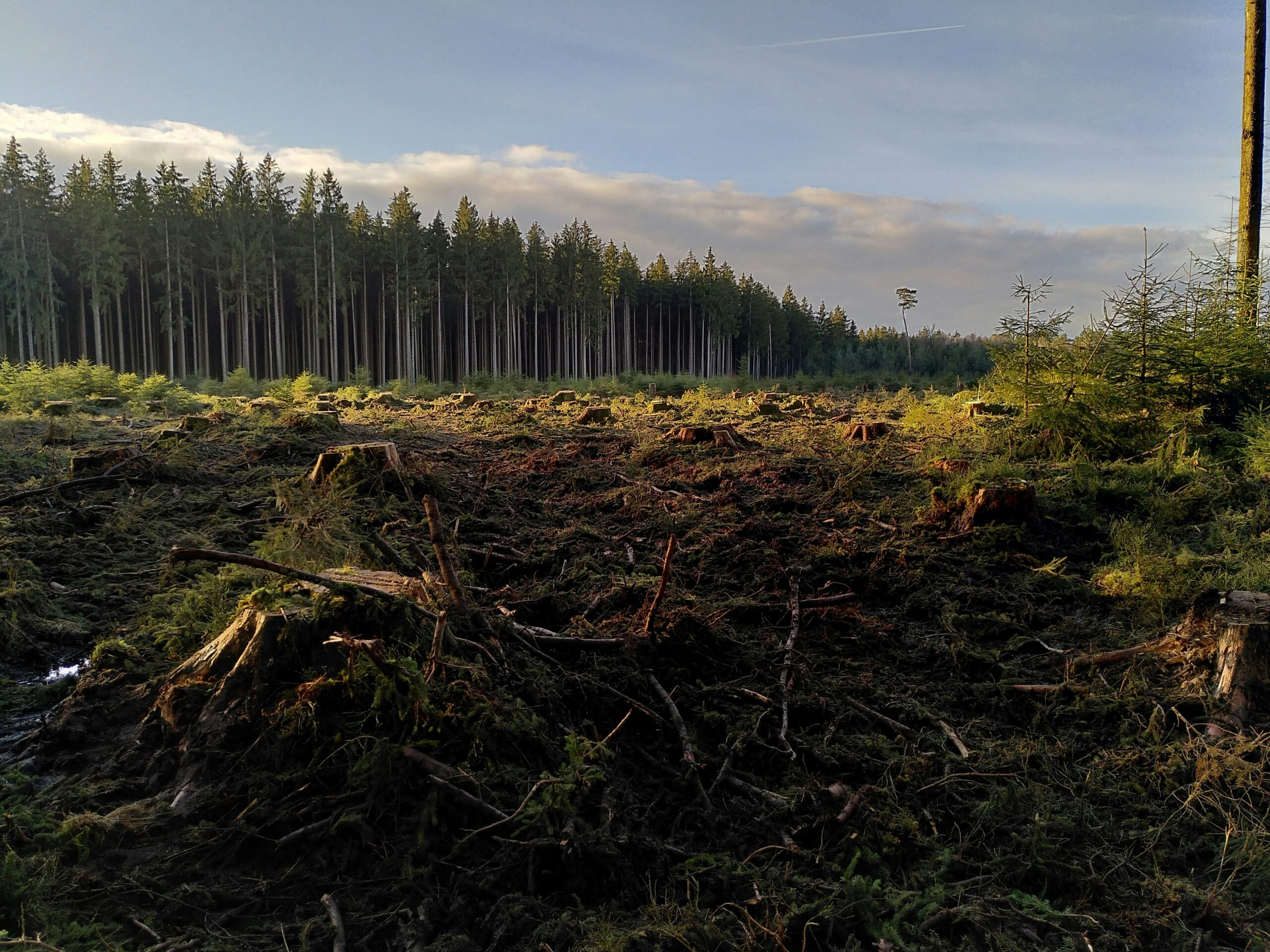
Tracking forest loss from the ground is no longer practical at scale. Remote sensing now plays a central role in how deforestation is detected, documented, and addressed – particularly for companies subject to environmental due diligence. From high-resolution satellite imagery to AI-driven risk alerts, remote sensing offers a direct path to transparency. The question is no longer whether to use it, but how to make it work across compliance, supply chains, and operational systems.
What Is Remote Sensing and How It Works in Forest Monitoring
Remote sensing refers to the process of gathering information about land surfaces without making physical contact. In forest monitoring, that usually means collecting satellite or aerial imagery to assess changes in tree cover, land use, or vegetation health over time. What makes it especially relevant now is the scale and speed it offers – monitoring thousands of hectares at once, often in near real time.
Most remote sensing systems rely on sensors mounted on satellites, drones, or aircraft. These sensors detect different wavelengths of light, including visible, infrared, and radar, to produce images that reflect the condition of the forest below. By comparing images from different time periods, analysts – or in many cases, algorithms – can flag areas where forest loss has occurred. That includes clearcutting, illegal logging, or gradual degradation that might otherwise go unnoticed.
This kind of monitoring doesn’t replace field checks, but it narrows the search and provides evidence that’s both scalable and timestamped. In a regulatory environment where traceability and verification matter more than ever, remote sensing is quickly becoming the starting point for any serious deforestation risk assessment.
EUDR: Supporting Remote Sensing Compliance Under the EU Deforestation Regulation
En EUDR, we work with companies that need to prove their products aren’t tied to recent deforestation. The regulation is clear: if you trade commodities like soy, cocoa, palm oil, or timber in the EU, you’re responsible for showing exactly where they came from – and that the land wasn’t cleared after the cut-off. Remote sensing is often the starting point, but what matters most is whether the evidence you submit can actually stand up to scrutiny.
We help translate satellite data into documentation that meets EUDR standards. That means verifying geolocation, mapping risk, and supporting the preparation of due diligence statements that regulators can trust. If you’re unsure whether your current process is enough – or you’re still figuring out where to begin – drop us a line at info@eudr.com. We’ll help you break it down without overcomplicating things.
Remote Sensing in Practice: How AI and Open Data Power Modern Monitoring
Remote sensing stopped being just a research tool the moment open-access data and machine learning models became part of the standard toolkit. Today, companies under regulatory pressure aren’t just watching forests from above – they’re using that data to make legal claims, flag risks early, and structure compliance workflows. Here’s what that looks like in real terms.
Open-Access Data Sets Are Reshaping What’s Possible
Remote sensing used to be expensive and fragmented. Platforms like Planet and initiatives like the NICFI imagery program have made high-resolution satellite data widely available, with historical datasets often accessible for free and current data available through programs like the Tropical Forest Observatory. These datasets give direct access to multi-band imagery (including near-infrared) with updates as often as monthly. That frequency makes it possible to spot changes fast, even across huge areas like the Amazon or Southeast Asia.
When combined with geolocation data from supply chains, this kind of open imagery is more than just a visual – it becomes a verification tool. For EUDR compliance, that matters. You’re not just observing forest cover. You’re documenting whether land use aligns with legal cut-off dates.
Machine Learning Does the Heavy Lifting
The scale of this data makes manual analysis unrealistic. That’s where AI comes in. Models like ResNet50 – often trained on labeled imagery datasets – can flag tree loss, agricultural expansion, or fire damage automatically. Some systems, such as those developed during the Planet: Understanding the Amazon from Space Kaggle challenge, use convolutional neural networks to classify land features with over 90% accuracy, often leveraging compressed satellite images.
Of course, no model is perfect out of the box. False positives and misclassifications still happen, especially in cloudy or transitional zones. But the value isn’t just in raw detection – it’s in how quickly risks can be flagged, investigated, and documented. That’s a big shift for due diligence, where speed and traceability go hand in hand.
From Pixels to Actionable Evidence
The real power of combining open data with AI isn’t in the image – it’s in what you can prove. Remote sensing tools aren’t just showing change; they’re timestamping it, aligning it with land-use claims, and helping teams prepare audit-ready documentation. When the goal is to demonstrate that sourcing isn’t tied to post-2020 deforestation, evidence has to be structured, not just visual.
Modern platforms now export deforestation alerts, change detection reports, and even pre-built risk maps. All of this feeds into traceability systems, giving legal and procurement teams the kind of clarity they need to meet EUDR obligations without guesswork.
Where Remote Sensing Gets Complicated: Practical Limitations to Watch For
Remote sensing brings scale, speed, and visibility – but it’s not flawless. For teams trying to use satellite data to support compliance or flag forest risks, there are still a few things that regularly get in the way. Here’s what tends to trip people up.
- Cloud cover blocks the view: Optical satellites can’t see through clouds, which means key regions – especially in tropical zones – often go dark for weeks or months. If your monitoring depends on visible or near-infrared bands alone, gaps in the data are hard to avoid.
- Resolution doesn’t always match your needs: Not all satellite images are created equal. Some offer detail down to a few meters, others just a general landscape view. When boundaries are unclear or plots are small, low-res data may not hold up in a compliance context.
- Temporal gaps create blind spots: Even with public data becoming more frequent, there’s still a trade-off between resolution and revisit time. Monthly mosaics may miss short-term events like selective logging or land clearing that happens between captures.
- AI models don’t always generalize: A machine learning model trained to spot deforestation in one region won’t always perform the same elsewhere. Terrain, crop types, and seasonal shifts vary, and without local ground-truth data, false positives can stack up quickly.
- Geolocation data isn’t always precise: For EUDR compliance, you’ll need coordinates with real accuracy. If sourcing locations are vague, incomplete, or not tied to usable land maps, no satellite tool can fill in the blanks.
- File formats and platforms don’t align: Many teams get stuck at the stage of pulling data into something usable. Geotiffs, shapefiles, and raw pixel arrays need to be processed and aligned with your traceability system – which often takes more time than expected.
These aren’t reasons to avoid remote sensing – they’re reminders to approach it with the right expectations, tools, and workflows. Knowing where the limits are makes it easier to build a monitoring system that actually works in practice.
Real-World Applications: From Risk Detection to Policy Enforcement
Remote sensing isn’t just about watching forests change – it’s about turning those observations into actions that hold up in real-world contexts. Whether you’re part of a compliance team, a regulator, or a company mapping out its supply chain, here’s where this technology already plays a measurable role.
1. Identifying High-Risk Zones Before Sourcing
Before a product hits the EU market, businesses are expected to know where it came from – and whether that land was cleared after the cut-off date. Satellite imagery helps flag high-risk plots long before goods move through procurement channels.
- Detects active deforestation near sourcing zones
- Helps map overlaps between concessions and forest cover
- Highlights regions with seasonal land clearing or recurring fires
- Supports pre-trade risk classification under EUDR
2. Verifying Land-Use Claims with Satellite Evidence
If a supplier says their land hasn’t been cleared since 2020, it’s on the buyer to verify that claim. Remote sensing provides independent, time-stamped evidence to support or challenge what’s on paper.
- Compares historical imagery to confirm forest stability
- Validates coordinates in geolocation declarations
- Supports documentation for due diligence statements
- Strengthens audit readiness with visual change records
3. Supporting Legal and Regulatory Oversight
Government agencies and oversight bodies use remote sensing to monitor compliance at scale. It helps prioritize where to investigate, which areas need enforcement, and where illegal clearing may be taking place under the radar.
- Monitors protected areas for unauthorized land use
- Detects forest loss in remote or politically sensitive regions
- Aids in cross-checking trader declarations
- Informs legal action with geospatial proof
4. Tracking Restoration and Conservation Progress
Deforestation isn’t the only story. Remote sensing also plays a role in measuring forest recovery, monitoring reforestation projects, and ensuring long-term conservation commitments are being met.
- Maps canopy growth and replanting zones
- Tracks degradation reversal over time
- Measures project impact for carbon offset verification
- Supplies updates for environmental reporting
Remote Sensing and the Future of Forest Transparency
Forest monitoring isn’t just becoming faster – it’s becoming harder to ignore. With public satellite imagery, AI-based analysis, and rising regulatory pressure, it’s no longer enough to say your supply chain is clean. You need to show it. Remote sensing tools give companies and regulators a shared source of truth: a timestamped, location-specific record of what’s happening on the ground. That kind of visibility makes it possible to flag issues early, back up land-use claims, and respond faster when risks emerge.
The next phase of transparency isn’t about more data – it’s about making that data usable in a compliance context. That means building systems that connect remote sensing outputs directly to due diligence processes, traceability platforms, and regulatory submissions. As the legal burden shifts further toward verifiable proof, companies that treat monitoring as a reactive exercise will fall behind. The ones who treat it as infrastructure – embedded, automated, and audit-ready – are the ones that will stay ahead.
Conclusión
Remote sensing has changed the way we monitor forest loss – from reactive fieldwork to near real-time detection at scale. But data alone doesn’t solve deforestation. The value comes from how it’s used: aligning satellite evidence with legal expectations, embedding it into compliance systems, and making sure the right people see the right signals at the right time.
For companies navigating EUDR or other forest-risk regulations, this isn’t just about technology – it’s about documentation that holds up under scrutiny. As more jurisdictions follow the EU’s lead, remote sensing won’t be an optional add-on. It will be one of the few ways to meet the legal standard for transparency.
PREGUNTAS FRECUENTES
1. What exactly counts as remote sensing in the context of forest monitoring?
Most often, it means collecting satellite or drone imagery to track vegetation, land use, or tree cover over time – without setting foot in the area.
2. Do I need a high-tech setup to use remote sensing for compliance?
Not necessarily. Many platforms now offer user-friendly tools with pre-processed data and built-in alerts. But making that data useful still takes planning, especially around traceability and reporting.
3. Is free satellite data good enough for due diligence under EUDR?
That depends on how it’s used. Public imagery can absolutely support compliance, but it must be tied to verified sourcing locations and used to back up clear documentation.
4. How often should remote sensing data be reviewed?
There’s no fixed rule, but regular monitoring is key – especially in high-risk zones. Monthly or quarterly reviews are common where the risk of change is high.
5. Can remote sensing detect illegal logging immediately?
In many cases, yes. Some platforms issue alerts within days of canopy loss. That said, interpretation still matters – AI may spot anomalies, but someone needs to confirm what actually happened.
6. What about smallholder plots or mixed-use land?
These are often harder to monitor due to resolution limits or unclear boundaries. That’s where combining remote sensing with field data or local context becomes important.
7. Does using remote sensing guarantee compliance?
No. It’s a tool, not a legal shield. But when integrated properly, it gives you the kind of evidence and traceability that regulators are increasingly expecting to see.