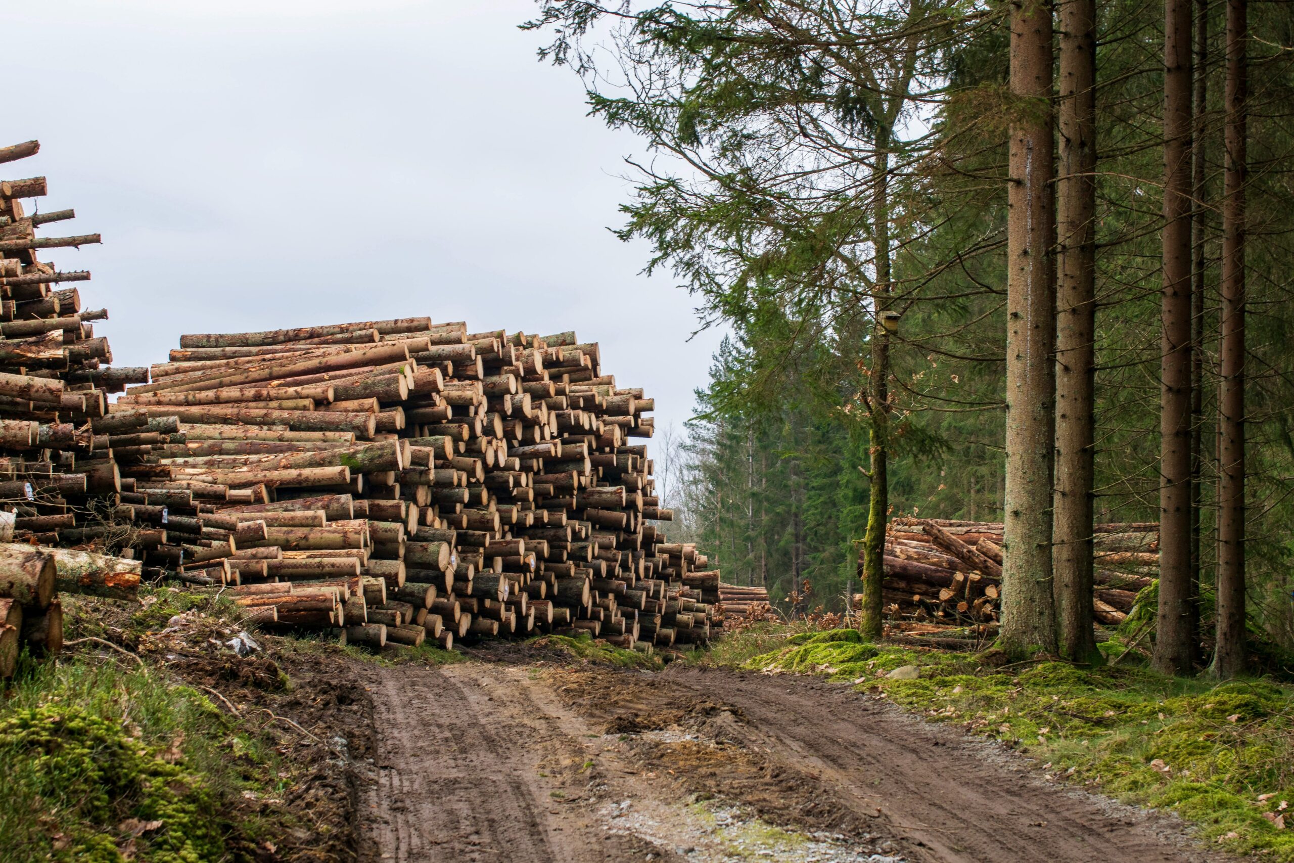
Detecting illegal deforestation isn’t just a technical challenge – it’s a compliance risk, a reputational hazard, and in many sectors, a regulatory requirement. As scrutiny around supply chains grows, especially with frameworks like the EU Deforestation Regulation (EUDR), companies are turning to software platforms that convert raw satellite data into actionable insights. These tools don’t just visualize tree loss – they flag risks early, trace origins, and help prove due diligence across commodity flows. Below is a closer look at the solutions organizations are using to operationalize forest monitoring in practice.
1. EUDR
EUDR isn’t a software tool, but it’s the reason most companies are now investing in deforestation monitoring solutions in the first place. The regulation sets the legal framework that forces businesses to prove their products aren’t linked to deforested land. That means even the most advanced tracking platform is only useful if it’s aligned with what EUDR actually requires – geolocation data, traceable supply chains, and risk assessment for high-priority commodities.
We help make sense of that shift. EUDR flips the traditional model: instead of asking authorities to prove wrongdoing, it’s on companies to prove compliance. That’s where monitoring tools come in. They support the evidence gathering, but the regulation is what defines the rules. Our role is to explain those rules clearly and help businesses apply the right tools and processes to stay compliant.
Főbb jellemzők:
- Defines what counts as deforestation-free under EU law
- Forces companies to use monitoring tools for supply chain evidence
- Supports traceability by requiring full geolocation of origin plots
- Enables enforcement through reversed burden of proof
- Applies across multiple high-risk commodity categories
Kinek ajánlott:
- Businesses placing forest-risk products on the EU market
- Supply chain and procurement teams handling global sourcing
- Legal teams needing to understand documentation thresholds
- ESG and compliance officers building risk-based due diligence systems
Elérhetőségek:
- Weboldal: eudr.co
- E-mail: info@eudr.com
- Cím: Robert-Bosch-Str. 7, 64293 Darmstadt,Németország
- Telefon: +49 6151 2776497
2. Global Forest Watch
Global Forest Watch provides access to near real-time satellite data for tracking forest loss across the globe. While it’s not a software for managing compliance, it plays a critical role in supporting illegal deforestation detection, particularly in the early stages of land clearing. The platform offers interactive maps, dashboards, and data layers that help companies visualize forest cover change across their sourcing areas.
In the context of EUDR and similar regulations, tools like this help establish whether commodity-linked land plots are free from recent deforestation. They don’t replace legal due diligence processes, but they provide a credible data source that feeds into supply chain risk assessments. By integrating these insights early, companies can better target where more detailed verification or on-the-ground checks are needed.
Főbb jellemzők:
- Offers satellite-based forest cover monitoring
- Provides alerts on recent deforestation events
- Includes public dashboards and downloadable data
- Can be used to support risk assessments under EUDR
- No registration required to access core map functions
Kinek ajánlott:
- Sustainability teams needing early warning data
- Procurement managers working in forest-risk supply chains
- NGOs and third-party auditors conducting land use checks
- Compliance teams looking to cross-reference land sourcing
- Researchers monitoring regional deforestation trends
Elérhetőségek:
- Honlap: www.globalforestwatch.org
- E-mail: Kaitlyn.Thayer@wri.org
- Facebook: www.facebook.com/globalforests
- Twitter: x.com/globalforests
- LinkedIn: www.linkedin.com/showcase/globalforestwatch
- Instagram: www.instagram.com/globalforests
3. Omdena
Omdena uses AI to help detect and predict deforestation by analyzing large volumes of satellite imagery and contextual data. Their solutions are not off-the-shelf compliance software, but project-based AI applications built for identifying patterns in forest loss, road construction, or unauthorized clearing. This kind of modeling helps organizations understand where illegal deforestation is likely to happen, not just where it already has.
They’ve also worked on projects related to illegal logging detection, reforestation planning, and land restoration, all of which intersect with regulatory pressure from frameworks like EUDR. What makes their approach useful is the custom nature of their work – combining local factors, predictive models, and imagery to flag high-risk zones and operational blind spots before they turn into violations.
Főbb jellemzők:
- Develops AI models for deforestation detection and risk prediction
- Supports illegal logging pattern identification
- Enables custom model creation based on land use and human activity
- Partners with organizations for tailored monitoring solutions
- Doesn’t require third-party data transfers
Kinek ajánlott:
- Organizations needing tailored AI tools for high-risk sourcing
- Teams working with fragmented or large-scale land datasets
- Sustainability analysts mapping deforestation drivers
- Local stakeholders aiming to prioritize reforestation zones
- Research groups studying long-term land use dynamics
Elérhetőségek:
- Honlap: www.omdena.com
- Facebook: www.facebook.com/OmdenaAI
- Twitter: x.com/OmdenaAI
- LinkedIn: www.linkedin.com/company/omdena
- Instagram: www.instagram.com/omdenaglobal
4. EOSDA LandViewer
EOSDA LandViewer is a satellite image analysis tool that helps detect both legal and illegal forest clearing. While it’s not positioned as compliance software, it contributes directly to deforestation monitoring workflows. Users can select a region, apply vegetation indices, and analyze historical trends to flag clearing events that may violate sourcing policies or regulatory standards.
In connection to EUDR, this platform helps verify whether deforestation occurred within specific sourcing plots, offering visual and analytical evidence. It supports multiple spectral indices like NDVI, EVI, and NBR, making it possible to detect clear-cutting, degradation, and even early signs of drying in vulnerable areas. For businesses required to demonstrate due diligence, this type of monitoring tool adds a strong layer of traceability without requiring in-field inspections.
Főbb jellemzők:
- Detects forest loss using high-resolution satellite imagery
- Supports advanced vegetation index analysis (NDVI, EVI, NBR, etc.)
- Enables custom area-of-interest mapping
- Allows users to assess both legal and illegal deforestation
- Aligns with data requirements under deforestation-free sourcing rules
Kinek ajánlott:
- Companies needing image-based land use validation
- Analysts monitoring forest health across multiple regions
- Compliance teams preparing documentation for EUDR
- Environmental consultants verifying deforestation claims
Elérhetőségek:
- Honlap: eos.com
- E-mail: sales@eosda.com
- Facebook: www.facebook.com/EOSDA
- Twitter: x.com/eos_da
- LinkedIn: www.linkedin.com/company/eos-data-analytics
- Instagram: www.instagram.com/eosdataanalytics
- Cím: El Camino Real, Suite 180, Mountain View, CA 94040 USA
5. MAAP (Monitoring of the Andes Amazon Program)
MAAP provides real-time forest monitoring across the entire Amazon basin, using a combination of satellite imagery, drones, radar, and custom algorithms. The tool is designed to detect illegal deforestation as it happens and flag high-risk areas for further investigation. It’s operated by Amazon Conservation and has become a key resource for law enforcement and local groups tracking unauthorized clearing in hard-to-access zones.
While MAAP doesn’t replace due diligence systems, it plays a direct supporting role in identifying where illegal activity may be taking place. Reports are issued both publicly and confidentially, depending on the case, and the platform helps stakeholders narrow down where attention is urgently needed. For supply chains or sourcing regions overlapping with Amazonian countries, MAAP’s data can feed into EUDR-aligned verification efforts.
Főbb jellemzők:
- Detects illegal deforestation using real-time satellite and radar imagery
- Covers the full Amazon basin across nine countries
- Supports law enforcement and local response teams
- Identifies urgency level and location of forest loss
- Combines multiple sensors and custom alerting algorithms
Kinek ajánlott:
- Organizations sourcing commodities from Amazon regions
- Government agencies tracking enforcement gaps
- NGOs involved in land protection or rights monitoring
- Companies needing external alerts to inform their supply chain risk
- Verification partners conducting deforestation screening
Elérhetőségek:
- Honlap: www.maapprogram.org
- Facebook: www.facebook.com/AmazonConservation
- Twitter: x.com/ACA_DC
- LinkedIn: www.linkedin.com/company/amazon-conservation-association
- Instagram: www.instagram.com/amazonconservation
6. GRAS
GRAS provides land use change and deforestation monitoring services tailored for supply chain risk analysis. It supports companies with zero-deforestation commitments by verifying land history and identifying areas of recent or past forest clearance. GRAS uses remote sensing, crop expansion tracking, and satellite-based risk models to flag violations or high-risk suppliers before they enter the sourcing pipeline.
For EUDR compliance or similar frameworks, GRAS helps confirm whether land was deforested before sourcing began. It doesn’t replace internal systems, but it adds a technical layer that companies can use to pre-screen regions, validate supplier claims, or prepare for third-party certification audits. It also helps document non-compliance cases that would otherwise be difficult to prove.
Főbb jellemzők:
- Tracks historical and recent deforestation at field or regional level
- Supports analysis of crop-driven land use change
- Uses satellite imagery to monitor protected and high-carbon zones
- Can be used to verify deforestation cut-off dates in sourcing areas
- Offers pre-audit assessments and certification support
Kinek ajánlott:
- Businesses sourcing from high-deforestation-risk commodities
- Certification bodies requiring independent land use verification
- Supply chain managers looking to flag early risks
- ESG teams mapping historical land changes across suppliers
- Auditors working in remote or hard-to-access regions
Elérhetőségek:
- Website: www.gras-system.org
- E-mail: info@gras-system.org
- Address: Hohenzollernring 72, D-50672 Köln
- Phone: +49-221-50802030
7. UP42
UP42 offers satellite-based deforestation monitoring capabilities through a modular platform that integrates directly into existing workflows. It’s not a standalone app, but a backend data processing system where users can select imagery, apply deforestation detection algorithms, and output results as API-ready files. This flexibility makes it a useful option for teams who want deforestation data without managing another full software layer.
From a regulatory angle, UP42 supports illegal deforestation monitoring by providing repeatable, traceable outputs showing when and where forest loss occurred. The system can be used to automate tracking across large sourcing zones and helps document land changes over time. For teams building their own compliance stacks, UP42’s API and SDK make it easy to plug geospatial alerts into due diligence flows.
Főbb jellemzők:
- Delivers deforestation alerts using high-resolution imagery
- Supports automation through Python SDK and API
- Compatible with various satellite sources (Sentinel, Pleiades, etc.)
- Offers binary and heatmap outputs for forest change events
- Can be integrated into internal compliance or GIS tools
Kinek ajánlott:
- Tech teams building their own land monitoring tools
- Large organizations needing scalable geospatial workflows
- ESG departments that prefer direct integration over new platforms
- Consultants developing custom sourcing dashboards
Elérhetőségek:
- Weboldal: up42.com
- E-mail: sales@up42.com
- Facebook: www.facebook.com/up42Official
- Twitter: x.com/UP42_
- LinkedIn: www.linkedin.com/company/up42
- Instagram: www.instagram.com/up42official
- Address: Umspannwerk Kreuzberg, Ohlauer Str 43, Berlin
8. ARBIO Open Source Monitoring
ARBIO emphasizes conservation of the Amazon rainforest, wildlife monitoring using camera traps, and sustainable management, but does not explicitly promote or provide low-cost, open-source tools or satellite imagery for local deforestation detection as claimed. While this is not a commercial platform or regulatory tool, ARBIO’s method strengthens the early detection layer in local deforestation monitoring efforts.
By improving the availability and use of spatial data at ground level, these tools contribute to faster reporting and response to illegal activity. For organizations or jurisdictions dealing with remote or under-monitored regions, this kind of open infrastructure can complement compliance frameworks like EUDR by supplying early evidence of land disturbance.
Főbb jellemzők:
- Promotes local-level monitoring using open-source software
- Enables detection of deforestation with freely available satellite imagery
- Focuses on real-time, ground-based response to forest change
- Supports community-level training and capacity building
- Complements broader regulatory frameworks through local input
Kinek ajánlott:
- Forest managers in remote Amazonian areas
- NGOs supporting early detection of illegal logging
- Community groups handling land rights and conservation
- Local governments needing lightweight, cost-free solutions
- Projects combining top-down regulation with bottom-up data
Elérhetőségek:
- Website: www.arbioperu.org
- E-mail: info@arbioperu.org
- Facebook: www.facebook.com/arbioperu
- Twitter: x.com/ArbioPeru
- LinkedIn: www.linkedin.com/company/asociacion-arbio-amazonia
- Instagram: www.instagram.com/arbioperu
9. osapiens HUB for EUDR
Osapiens HUB for EUDR is a dedicated compliance platform designed to automate processes around the EU Deforestation Regulation. While it isn’t a monitoring tool in the traditional sense, it includes satellite-based deforestation risk assessments that help companies identify areas of concern before sourcing begins. These insights are integrated directly into the due diligence process and contribute to the required submission of geolocation-linked statements to EU authorities.
The tool functions as a structured workflow environment that pulls together data collection, risk scoring, supplier inputs, and statement preparation. In the context of illegal deforestation, osapiens HUB provides the structure to prove that specific land plots have not been recently cleared, using integrated spatial data and rule-based assessment logic.
Főbb jellemzők:
- Automates deforestation risk assessments using satellite data
- Prepares and submits Due Diligence Statements for EUDR
- Integrates supplier data, geolocation, and audit documentation
- Includes legality checks and evidence-based risk mitigation
- Supports workflows for traders, operators, and exporters
Kinek ajánlott:
- Companies importing or selling forest-risk commodities in the EU
- Legal and compliance teams managing regulatory submissions
- Procurement departments verifying plot-level deforestation status
- Enterprises needing structured due diligence and traceability
- Stakeholders preparing for EUDR audits or third-party checks
Elérhetőségek:
- Honlap: osapiens.com
- LinkedIn: www.linkedin.com/company/osapiens

10. FAO National Forest Monitoring Systems (NFMS)
FAO supports governments in building national-scale forest monitoring systems that combine satellite land monitoring, forest inventories, and geospatial analysis tools. These systems are not plug-and-play software, but government-managed platforms built for consistent and verifiable reporting of land use and forest change. They provide the technical backbone for REDD+ reporting, national carbon accounting, and verification of legal forest use.
For illegal deforestation detection, NFMS platforms help identify and quantify unauthorized land use change. Many include public-facing geoportals or integrate with open-source tools like Collect Earth and SEPAL. Their role in regulatory frameworks is foundational: they generate the activity data that underpins national reporting, due diligence, and evidence-based enforcement.
Főbb jellemzők:
- Enables country-level deforestation monitoring through satellite and inventory data
- Supports national greenhouse gas inventories and forest carbon reporting
- Includes tools like SEPAL and Collect Earth for data entry and visualization
- Provides technical training and system integration support
- Can feed into compliance efforts for global forest-related regulations
Kinek ajánlott:
- National governments managing forest sector transparency
- Ministries responsible for land use and emissions reporting
- International partners supporting REDD+ and climate goals
- Certification bodies seeking validated country-scale data
Elérhetőségek:
- Website: www.fao.org
- E-mail: FAO-HQ@fao.org
- Facebook: www.facebook.com/UNFAO
- Twitter: x.com/FAO
- LinkedIn: www.linkedin.com/company/fao
- Instagram: www.instagram.com/fao
- Address: Viale delle Terme di Caracalla, 00153 Rome, Italy
- Phone: (+39) 06 57051
Következtetés
There’s no single tool that solves illegal deforestation. What we’re seeing instead is a network of systems – some open-source, some regulatory, others fully commercial – working in parallel to improve visibility and accountability across land use. From real-time satellite alerts to national inventory systems and EUDR-aligned compliance hubs, each solution plays a different part in the chain of detection, verification, and documentation.
As regulations like the EU Deforestation Regulation shift responsibility onto companies and suppliers, monitoring tools are no longer just technical add-ons – they’re a functional requirement. The challenge now is integrating these tools in a way that reflects real sourcing conditions, without overcomplicating what should be a focused due diligence process. Whether you’re sourcing from Amazon or managing supplier data from your desk, understanding which tool fits where is a key part of staying aligned – not just with compliance, but with the bigger picture of forest protection.