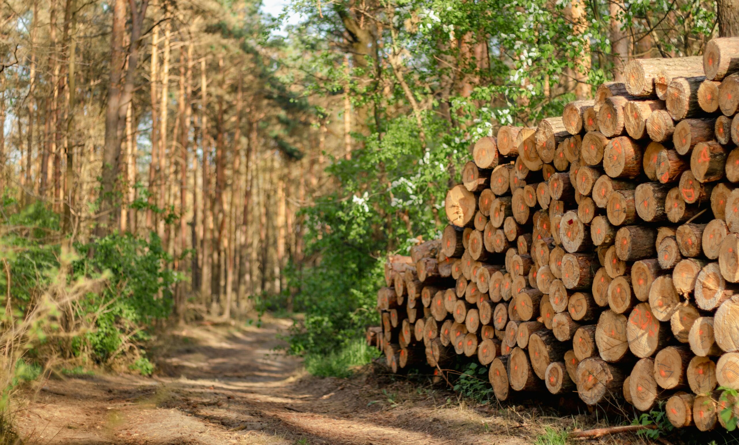
If you work with commodities like coffee, cocoa, soy, or timber, you’ve probably heard about the EU Deforestation Regulation (EUDR). What’s getting most companies’ attention right now isn’t just the paperwork or due diligence statement – it’s the geolocation data behind it. The regulation demands that every product entering the EU can be traced back to the exact plot of land where it was produced. Not just the region or farm name, but the real coordinates, down to a few meters. It sounds technical, and it is, but understanding it early can save you from serious headaches when enforcement kicks in.
In this guide, we’ll break down what geolocation actually means under the EUDR, how precise the data needs to be, and what tools make the process manageable. Think of it as a practical walkthrough, not a legal lecture.
Why Geolocation Matters for Compliance
Geolocation isn’t just a technical field to fill in a form. It’s the foundation of your entire compliance claim. Without it, you cannot submit a valid Due Diligence Statement (DDS) in the EU’s TRACES system, which means your shipment won’t clear customs.
It matters because it provides tangible proof that your supply chain is deforestation-free and links your commodities directly to verified land plots. It also allows authorities to cross-check your data against satellite imagery, reducing the risk of rejection, penalties, or loss of market access.
If your coordinates are incomplete, imprecise, or linked to the wrong area, your DDS can be flagged as non-compliant. One wrong point can hold up an entire shipment or even trigger an investigation.
What the EUDR Requires in Practice
The EUDR is very specific about the level of precision required. It doesn’t settle for vague labels like “region” or “farm name.” Companies must submit the exact geographic coordinates of every plot of land used to produce the relevant commodities.
That means:
- Coordinates must be in decimal degrees with at least six digits of precision.
- Small plots (less than 4 hectares) can be represented by a single point.
- Larger plots (over 4 hectares) must be mapped using a polygon that outlines the boundaries.
- The data must be submitted in GeoJSON format with a WGS84 (EPSG:4326) projection.
In short, the system removes any room for uncertainty. It creates a single, consistent standard that links every shipment back to the real-world land where it began – something traditional documentation has never been able to guarantee.
Point vs. Polygon: What’s the Difference
This part often confuses people, so let’s break it down in plain language.
- Point data is like dropping a pin in the middle of a field. It gives one coordinate pair (latitude and longitude) that represents the location of production.
- Polygon data, on the other hand, outlines the entire field, connecting multiple coordinates that trace its perimeter.
Points are allowed for small farms, but polygons are more accurate because they show boundaries and area. Auditors and satellite systems can verify whether deforestation happened within that exact shape.
Polygons are gaining traction because they provide a higher level of detail and reliability. They reduce the risk of false flags during satellite checks, make it easier to prove compliance in case of disputes, and support automated verification tools that detect tree cover loss.
While point data may still meet the minimum requirement today, the trend under EUDR is clearly moving toward polygon-based submissions as the preferred standard for compliance.

EUDR.co: Your Partner in Compliance and Traceability
La EUDR.co, we built our platform around one simple goal: making EUDR compliance practical, not painful. We understand that most companies aren’t struggling with why compliance matters – they’re struggling with how to get it done right. That’s why our tools are designed to simplify every step, from data collection to final reporting.
Making Compliance Simple and Practical
Our solution automates the most time-consuming parts of the process. With satellite-based monitoring and AI-driven data validation, we help you verify deforestation-free supply chains in real time. The system connects directly to your suppliers, checks geolocation data for accuracy, and prepares reports that meet all EU submission standards.
Instead of managing dozens of spreadsheets and site visits, you can handle everything from one dashboard. Every field coordinate, supplier record, and compliance document stays organized, verified, and ready for audits.
Built for Businesses of All Sizes
We designed our platform to be accessible and affordable, because compliance shouldn’t be limited to big corporations. Whether you’re an exporter, a smallholder cooperative, or a mid-sized manufacturer, you can customize the platform to match your operations.
You get a clear view of your entire supply chain, risk alerts before they become problems, and automatic Due Diligence Statement generation for the TRACES system. It’s a scalable way to stay compliant without building a full internal compliance team.
Turning Complexity Into Confidence
Our mission is to help you move through EUDR requirements with confidence, not confusion. We take care of the technical and regulatory details so your business can focus on sustainable growth.
With EUDR.com, compliance isn’t just another burden – it becomes part of a smarter, more transparent way to operate.
How to Collect, Validate, and Verify Geolocation Data
Collecting geolocation data across multiple suppliers or smallholders can feel like a big task at first. But once you break it down into clear steps and use the right tools, the process becomes far more manageable. The key is to collect accurate data, verify it thoroughly, and keep it consistent across your supply chain.
Collecting Geolocation Data in the Field
There are several ways to capture accurate coordinates for each plot of land, depending on your operations and level of digital maturity.
1. Mobile Field Collection
Field agents or farmers can use GPS-enabled mobile apps to record coordinates directly on-site. Many modern tools also work offline, allowing data to be stored locally and synced later when internet access becomes available. This is especially useful for remote agricultural areas.
2. Web-Based Mapping
For farms that can already be identified on satellite imagery, web platforms let you manually draw plot boundaries using visual overlays. This method is great for verifying known production areas or mapping historic data without having to visit every field.
3. Automated or AI-Assisted Mapping
Some advanced platforms now use artificial intelligence to detect field boundaries automatically once a center point is provided. The system analyses satellite data to suggest accurate plot shapes, saving time and reducing human error.
No matter which method you choose, consistency is key. Every plot should be mapped using the same process, and each record must clearly link back to the correct supplier, product, and batch.
Verifying the Data for Accuracy
Submitting coordinates is only half the job. The EU requires that all geolocation data be verified to confirm it’s accurate and that no deforestation has taken place after December 31, 2020.
Most companies use a mix of approaches:
1. Internal Validation
This involves checking new data against existing records or previous harvests to make sure there are no inconsistencies or missing information.
2. External Validation
Third-party satellite datasets, such as those from the Hansen Global Forest Change project or the Joint Research Centre (JRC), can be used to verify deforestation status and ensure plots haven’t been cleared or degraded.
3. Independent Audits
Some companies go a step further by involving external auditors or specialized firms to cross-check coordinates and confirm compliance readiness.
A good rule of thumb is to treat geolocation like financial reporting. Every number should have a source, every record should be verifiable, and the data must always stand up to scrutiny. When your coordinates can be trusted, your entire compliance process becomes simpler, faster, and more defensible.
Common Mistakes That Cause Non-Compliance
Even well-prepared companies can get tripped up by small, technical errors that end up creating big problems during EUDR verification. These mistakes often happen not because of negligence, but because teams are working with fragmented systems, outdated tools, or inconsistent data from suppliers. Customs authorities and auditors regularly flag the following issues as red flags:
- Coordinates pointing to a warehouse or road instead of the actual plot. This usually happens when teams collect location data from administrative documents or shipping addresses instead of field-level mapping. The EU requires exact production coordinates, not approximate points of origin.
- Using shared or duplicate polygons for multiple suppliers. In some cases, data from one farm gets copied for several others, which makes it impossible to prove unique traceability. Every supplier must have its own verified plot data, even if they operate in the same area.
- Submitting incomplete or broken polygon shapes. Missing corners, open loops, or distorted boundaries can prevent the file from being processed correctly. If the geometry is invalid, the polygon can’t be verified through satellite checks, which often leads to automatic rejection.
- Reusing old location data that doesn’t match the current harvest. Fields change, boundaries shift, and ownership updates happen. Submitting outdated coordinates can create compliance gaps, especially if the land has been modified or reclassified since the last submission.
- Incorrect or corrupted GeoJSON file formats. One wrong character or formatting error can make a submission unreadable to the TRACES system. Files must follow strict EU format rules, including valid structure, correct projection, and clean coordinate data.
Each of these issues can result in shipment delays, rejections, or full-scale compliance reviews that stall trade operations. The easiest way to avoid them is by using software that automatically checks your data before submission.
When your data is validated in advance, you protect both your shipments and your reputation. It’s not just about getting compliant – it’s about staying audit-ready at all times.
Handling Complex Supply Chains and Bulk Commodities
This is where things get complicated. When your products come from hundreds of farms or go through multiple processing stages, keeping track of every plot can feel like a puzzle. Bulk commodities like soy, palm oil, or rubber often move through traders, aggregators, and processors before they ever reach the exporter. Each of those steps adds another layer of complexity, and potential risk.
Under the EUDR, you’re still responsible for connecting every batch of product to its exact point of origin. That means providing geolocation data for every contributing plot involved in production. If just one of those plots turns out to be non-compliant, the entire shipment can be flagged or rejected. There’s also no room for blending. Mixing compliant material with anything of unknown or unverifiable origin automatically makes the whole batch non-compliant. In other words, if you can’t separate the two, you lose compliance for the entire shipment.
Composite products bring their own challenges. Take chocolate, for example – it’s made from cocoa and sometimes palm oil. In cases like this, due diligence usually focuses on the main commodity defined by its HS code. So, for chocolate, that would be cocoa. You’d need full geolocation documentation for the cocoa plots, while palm oil might fall under a secondary verification layer.
For businesses dealing with bulk or blended products, this means setting up strong traceability systems and working closely with suppliers early in the process. When each plot, batch, and intermediary is documented properly, you reduce the risk of non-compliance and keep your products moving smoothly across borders.
The Role of Risk Assessment and Mitigation
Once you’ve gathered your geolocation data, the next step is figuring out how much risk each origin carries. The EUDR doesn’t just want proof of where your products come from – it wants assurance that they come from places unlikely to involve deforestation or illegal activity.
This means every company has to evaluate a few key factors before moving forward:
- Country or region-level deforestation risk: Some areas have a higher chance of forest loss due to weak enforcement or land-use pressure.
- Proximity to protected zones: Farms or plantations close to conservation areas require extra scrutiny.
- Presence of indigenous or local communities: You need to make sure production doesn’t interfere with land rights or livelihoods.
- Historical deforestation trends: Looking at satellite data from previous years helps identify whether the area has seen forest clearance after the 2020 cutoff.
- Complexity of the supply chain: The more intermediaries involved, the greater the risk of gaps or errors in data.
If your assessment shows a medium or high level of risk, the EUDR expects you to take action before putting the product on the EU market. That might mean carrying out another field check, providing training for suppliers, or using satellite revalidation to confirm the data.
Whatever you do, it has to be documented. Your Due Diligence Statement (DDS) should include every step you’ve taken to identify and reduce risk. Think of it as your paper trail – it’s what proves that you’ve done more than just collect coordinates. You’ve actively made sure your products are clean, traceable, and compliant from the ground up.
How to Stay Ready and Compliant
Building a compliant geolocation process doesn’t have to be overwhelming. The key is to start small and make steady progress. Here’s how to approach it step by step.
Step 1: Audit Your Supply Chain
Begin by identifying which commodities and suppliers in your network fall under EUDR. Knowing where your risks and responsibilities lie helps you prioritize resources and plan your data collection more efficiently.
Step 2: Standardize Data Collection
Use one consistent system or format for all geolocation data. When everyone in your supply chain follows the same structure, it becomes easier to verify coordinates, merge datasets, and submit reports without errors.
Step 3: Train Your Suppliers
Provide clear instructions and easy-to-use mapping tools for your partners. Many compliance issues start at the field level, so giving farmers and local suppliers access to mobile GPS apps or training sessions can save time later.
Step 4: Validate Your Data Regularly
Before every submission, run satellite checks or use verification software to ensure your coordinates are correct and up to date. Regular validation prevents small errors from turning into costly compliance setbacks.
Step 5: Integrate Your Systems
Connect your traceability platform with your ERP or compliance dashboard. Integrations reduce manual work and ensure all departments are working from the same verified data source.
Staying Ahead
The earlier you build these steps into your daily operations, the smoother your transition will be once EUDR enforcement begins in full. Preparing now not only reduces stress later but also positions your business as a reliable, transparent partner in global trade.
Wrapping It Up
The EUDR geolocation requirements are more than just another compliance task – they represent a new standard for transparency in global trade. By tying every product to its exact place of origin, the regulation is forcing companies to know their supply chains better than ever before. It may feel demanding now, but it’s also pushing the entire industry toward cleaner, more responsible production.
For businesses, this isn’t just about avoiding penalties or ticking boxes. It’s about building credibility, proving that your sourcing is ethical, and gaining the trust of buyers who increasingly care about sustainability.
Compliance might be mandatory, but doing it right can become a real competitive advantage.
Frequently Asked Questions (FAQ)
1. What exactly are EUDR geolocation requirements?
The EU Deforestation Regulation (EUDR) requires all companies placing certain commodities on the EU market, like coffee, cocoa, soy, palm oil, rubber, wood, and cattle – to submit precise geolocation data. This means providing the exact coordinates of every plot of land where those commodities were produced to prove that they’re deforestation-free.
2. What kind of geolocation data do I need to provide?
You must provide latitude and longitude coordinates in decimal degrees with at least six digits of precision. Small plots (under 4 hectares) can be represented by a single coordinate point, while larger plots must be mapped using a polygon that outlines their perimeter.
3. What file format does the EU require for submission?
All geolocation data must be submitted in GeoJSON format, using the WGS84 (EPSG:4326) projection system. This ensures compatibility with the EU’s TRACES Information System and enables satellite-based verification.
4. What’s the difference between point and polygon data?
A point is a single GPS coordinate that marks a location, while a polygon shows the full shape and boundaries of a field using multiple connected coordinates. Points are acceptable for small plots, but polygons are more accurate and preferred for compliance verification.
5. Who is responsible for collecting and submitting the data?
The responsibility falls on the operator, usually the first company placing the product on the EU market. Even if your supply chain involves multiple intermediaries, the operator must ensure that the geolocation data is valid, verified, and linked to every batch of product.