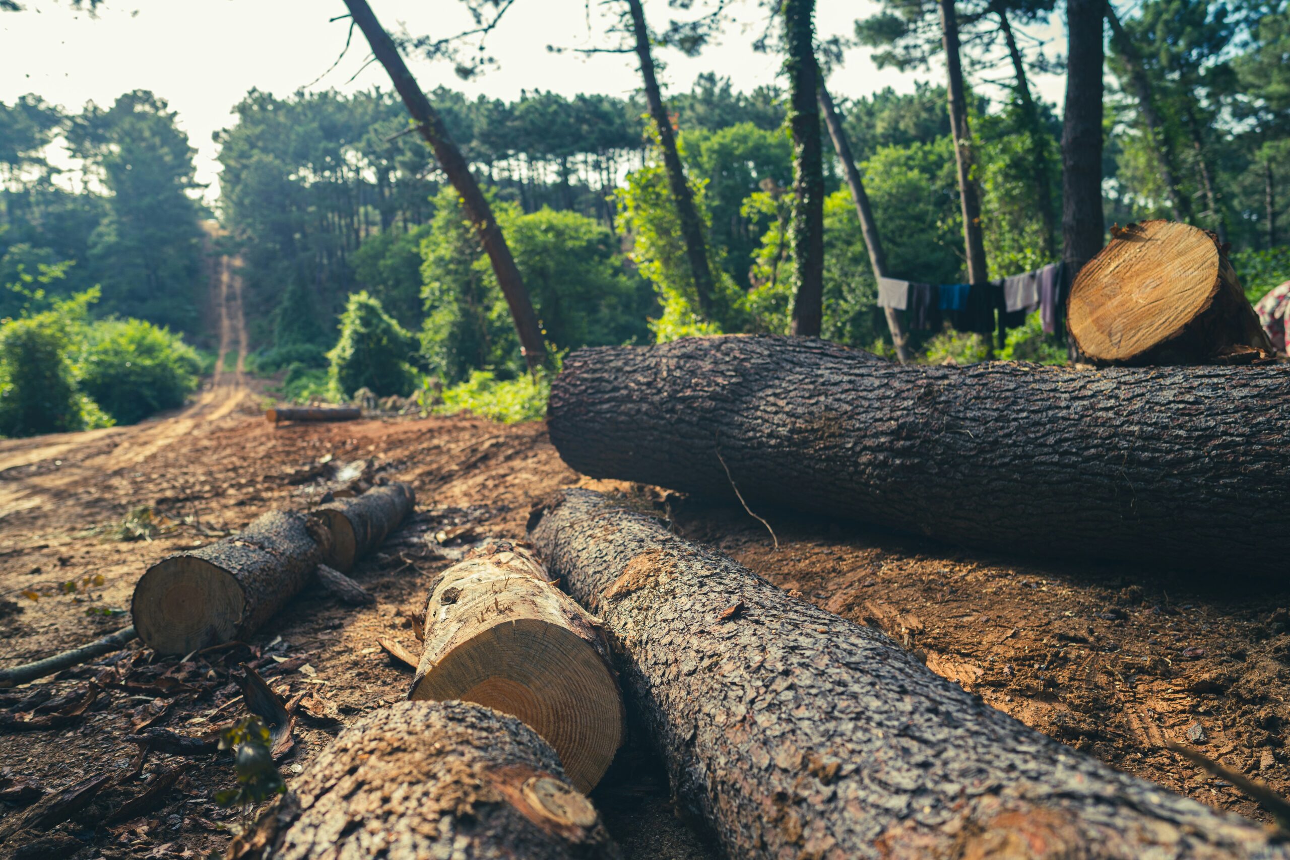
Deforestation monitoring is no longer just a data challenge – it’s a compliance and sustainability issue with real consequences. Companies across supply chains are under growing pressure to prove that their raw materials are not linked to illegal logging or recently cleared land. That means having reliable systems in place to track land use, flag risks, and store verifiable evidence.
From satellite analytics platforms to on-the-ground verification tools, the software landscape is evolving fast. Some systems focus on high-resolution alerts, others specialize in audit-ready reporting or API integrations that plug directly into procurement workflows. The tools featured below are designed to help organizations navigate the legal, technical, and operational layers of deforestation risk management across different regions and regulatory contexts.
1. EUDR
EUDR doesn’t build forest monitoring tools ourselves, but we work closely with the ones that do. Our role sits at the intersection of law, land use, and technology. For companies affected by the EU Deforestation Regulation, we help connect the dots between raw satellite data, due diligence obligations, and what regulators actually expect to see in a compliance report. It’s not always obvious how to turn land-use insights into a defensible audit trail, and that’s where we step in.
By focusing specifically on EUDR, we guide companies through the entire process of compliance – from understanding how geospatial tools fit into your risk assessments, to ensuring the evidence you collect meets legal thresholds. We also help teams evaluate monitoring solutions, assess supply chain vulnerabilities, and prepare for potential investigations. Monitoring tools are essential, but knowing how to use them for regulatory defense is just as important.
Klíčové body:
- Support focused specifically on EU Deforestation Regulation
- Guidance on integrating forest monitoring tools into legal workflows
- Help converting geospatial data into audit-ready documentation
- No proprietary software – independent advisory approach
- Services aligned with reversed burden of proof obligations
Pro koho je to nejlepší:
- Companies importing EUDR-covered commodities into the EU
- Legal, procurement, and sustainability teams preparing for audits
- Businesses needing help interpreting forest data in compliance terms
- Teams looking to build a defensible due diligence system
Kontaktní informace:
- Webové stránky: eudr.co
- E-mail: info@eudr.com
- Adresa: Robert-Bosch-Str. 7, 64293 Darmstadt,Německo
- Telefon: +49 6151 2776497

2. Starling
Starling is a satellite-based monitoring system developed through a collaboration between Airbus and the Earthworm Foundation. It provides forest change tracking across supply chains, helping organizations connect environmental data to sourcing activities. The platform blends satellite imagery with supply chain traceability features, allowing users to detect deforestation events and assess their relationship to specific commodity suppliers.
Users access the system via a web dashboard or integrate it into internal systems through APIs and reports. Starling supports long-term historical mapping, real-time alerts, and traceability reporting, covering high-risk commodities such as palm oil, soy, cocoa, rubber, timber, and pulp. In addition to monitoring deforestation, the platform includes tools for carbon assessment and land-use planning, supporting companies with broader sustainability goals alongside regulatory needs.
Klíčové body:
- Remote sensing platform combining satellite data with supply chain mapping
- Traceability layer linking deforestation alerts to supplier operations
- Dashboard, report, and API-based data access
- Carbon impact and land-use analysis features
Pro koho je to nejlepší:
- Companies sourcing EUDR-regulated commodities
- Organizations with global or multi-tiered supply chains
- Teams managing traceability and carbon reporting
- Public agencies supporting deforestation-free supply policy
- NGOs and institutions involved in landscape monitoring
Kontaktní informace:
- Website: space-solutions.airbus.com
- LinkedIn: www.linkedin.com/company/airbus-geospatial-and-secure-connectivity-solutions
3. Global Forest Watch
Global Forest Watch (GFW) is an open-access monitoring system offering real-time data on forest change, built to support environmental transparency and action. Operated by the World Resources Institute and partners, GFW aggregates satellite data, government records, and crowdsourced inputs into a single platform. The system delivers forest alerts, interactive maps, and dashboards that can be tailored by country, region, or risk profile.
Its flexible architecture allows users to visualize forest loss, gain, and degradation across global regions and integrate that data into sustainability or compliance strategies. GFW is widely used by NGOs, journalists, companies, and policymakers. While the platform does not offer custom traceability or audit-ready reporting out of the box, it plays a key role in screening and early warning workflows that feed into EUDR-aligned due diligence.
Klíčové body:
- Public platform with real-time forest change detection
- Global coverage with maps, alerts, and dashboards
- Integrates multiple data sources including satellites and field reports
- Accessible without licensing fees or proprietary tools
- Useful as a screening or risk detection layer
Pro koho je to nejlepší:
- NGOs and watchdog groups tracking forest health
- Companies needing a free tool to flag forest risks early
- Journalists or researchers investigating land-use trends
- Policymakers and public institutions promoting transparency
- Organizations combining open data with internal compliance systems
Kontaktní informace:
- Webové stránky: www.globalforestwatch.org
- E-mail: Kaitlyn.Thayer@wri.org
- Facebook: www.facebook.com/globalforests
- Twitter: x.com/globalforests
- LinkedIn: www.linkedin.com/showcase/globalforestwatch
- Instagram: www.instagram.com/globalforests
4. EOSDA LandViewer
EOSDA LandViewer is a browser-based satellite analytics platform that supports forest monitoring through a combination of optical imagery and vegetation indices. It’s built to detect deforestation, monitor fire damage, and assess overall forest health using tools like NDVI, NBR, and change detection. Users can analyze canopy conditions over time and identify stress zones or illegal activity across large regions.
While the platform is used across sectors, its capabilities are particularly relevant for those managing deforestation risk or needing to demonstrate EUDR compliance. With tools for custom band combinations, AOI-based analysis, clustering, and time series visualizations, LandViewer supports both early warning and retrospective verification.
Klíčové body:
- Optical satellite analytics platform with vegetation index tools
- Deforestation detection, fire mapping, and forest health assessment
- Supports NDVI, NBR, EVI, SAVI, and custom band combinations
- Tools for time series analysis, clustering, and change detection
Pro koho je to nejlepší:
- Forestry managers tracking land cover and disturbance
- Companies mapping canopy loss for EUDR alignment
- Analysts needing historical context for forest impact verification
- Research teams studying forest degradation patterns
- NGOs monitoring fires and illegal logging activities
Kontaktní informace:
- Webové stránky: eos.com
- E-mail: sales@eosda.com
- Facebook: www.facebook.com/EOSDA
- Twitter: x.com/eos_da
- LinkedIn: www.linkedin.com/company/eos-data-analytics
- Instagram: www.instagram.com/eosdataanalytics
- Adresa: El Camino Real, Suite 180, Mountain View, CA 94040 USA

5. ICEYE
ICEYE provides satellite-based Synthetic Aperture Radar (SAR) imagery for persistent deforestation monitoring, regardless of weather or lighting conditions. This makes it especially useful for detecting changes in dense, cloud-covered regions like tropical rainforests. The platform allows near-daily tracking of forest cover, helping organizations identify early signs of illegal logging, land conversion, or infrastructure encroachment.
Designed for high-frequency monitoring, ICEYE’s SAR constellation can deliver forensic-level change detection. It’s used to support response efforts by showing where forest loss is accelerating and which areas are at risk. Alongside deforestation alerts, the platform supports wildfire detection, carbon impact assessments, and enforcement targeting.
Klíčové body:
- SAR-based satellite monitoring that works in all weather and lighting
- Daily revisit capability for high-frequency change detection
- Suitable for dense canopy zones where optical imagery fails
- Supports wildfire monitoring and infrastructure intrusion tracking
- Enables targeted interventions based on clear spatial signals
Pro koho je to nejlepší:
- Organizations needing uninterrupted forest monitoring
- Compliance teams working in cloud-prone or tropical regions
- Law enforcement and government agencies planning interventions
- Operators managing remote forest assets or concessions
- Groups monitoring deforestation linked to roads, mining, or expansion
Kontaktní informace:
- Webové stránky: www.iceye.com
- Facebook: www.facebook.com/iceye
- Twitter: x.com/iceye_global
- LinkedIn: www.linkedin.com/company/iceye
- Adresa: Maarintie 6, 02150 Espoo, Finsko
6. Aidenvironment Real-time Deforestation Monitoring
Aidenvironment’s Real-time Deforestation Monitoring program combines satellite data, field research, and supply chain analysis to track forest loss and link it to corporate activity. Unlike platforms focused on technical analysis alone, this system is structured around accountability. It’s designed to identify who is behind deforestation events and to support external pressure on those actors through reports and data sharing with civil society, media, and regulators.
The program helps close the gap between deforestation detection and corporate response by naming responsible suppliers and encouraging buyer intervention. Data is shared regularly through open reports, often tied to specific commodities like palm oil, soy, and cattle. These reports have been used in advocacy, public campaigns, and legal strategies.
Klíčové body:
- Real-time forest monitoring linked to named supply chain actors
- Combines satellite imagery, field verification, and supply chain research
- Used by NGOs and media to drive accountability
- Regular reporting on commodity-linked deforestation cases
- Supports civil society engagement and legal follow-up
Pro koho je to nejlepší:
- NGOs holding companies accountable to deforestation commitments
- Journalists and campaigners investigating forest loss
- Procurement teams responding to risk alerts or reports
- Companies seeking to review supplier behavior
Kontaktní informace:
- Webové stránky: aidenvironment.org
- E-mail: eastafrica@aidenvironment.org
- LinkedIn: www.linkedin.com/company/aidenvironment
- Instagram: www.instagram.com/aidenvironment
- Adresa: Plot 99 Luthuli Avenue, Kampala, Uganda
- Telefon: +256 (0)393 20 88 17
7. Accountability Framework Monitoring Tools
The Accountability Framework highlights a group of monitoring tools that support deforestation and ecosystem conversion risk assessment, supply chain traceability, and outcome verification. These tools aren’t developed by the Framework itself but are recognized as suitable options for companies aiming to align with no-deforestation and no-conversion commitments.
Rather than prescribing a single solution, the Framework emphasizes context-specific selection – encouraging the use of near real-time alerts in high-risk sourcing areas, or government-recognized platforms where legal alignment is essential. Some of the listed tools, like Global Forest Watch Pro, Trase, Mapbiomas, or Soy on Track, are geared toward regional tracking or commodity-specific monitoring.
Klíčové body:
- Curated list of recognized tools aligned with deforestation-free supply chain standards
- Supports selection based on geography, resolution, ecosystem, and risk level
- Includes tools for traceability, land-use change detection, and risk mapping
- Flexible approach encouraging combined tool use for complex supply chains
- Recognizes alignment with regulatory or legal monitoring frameworks
Pro koho je to nejlepší:
- Companies implementing the Accountability Framework
- Teams integrating forest and land-use monitoring into sourcing policies
- Compliance leads mapping EUDR exposure across sourcing origins
- NGOs and initiatives benchmarking corporate progress
- Auditors seeking transparency in tool selection processes
Kontaktní informace:
- Website: accountability-framework.org
- E-mail: contact@accountability-framework.org
- LinkedIn: www.linkedin.com/company/accountability-framework
8. Open Foris
Open Foris is a suite of open-source tools developed with FAO to support land and forest monitoring through every stage of data collection, management, and geospatial analysis. It’s structured around key monitoring needs: field-level observations, image interpretation, and earth observation processing. The platform is designed for accessibility across technical backgrounds. It enables countries, NGOs, and private actors to build tailored monitoring workflows that feed into national forest inventories or supply chain reporting.
Open Foris is already used globally to support Measurement, Reporting, and Verification (MRV) frameworks under the UNFCCC, and its flexibility also makes it relevant to EUDR-related monitoring, especially in high-deforestation-risk areas where capacity building is still in progress.
Klíčové body:
- Open-source toolset supporting full land monitoring lifecycle
- Combines field data collection, image interpretation, and geospatial processing
- Used for MRV reporting and national forest inventory support
- Compatible with high-resolution satellite imagery and cloud platforms
- Supports localized, scalable monitoring in low-capacity regions
Pro koho je to nejlepší:
- National agencies managing forest data or REDD+ MRV
- Organizations building open and auditable monitoring systems
- Researchers creating custom deforestation analysis workflows
- NGOs and civil society monitoring land use at multiple scales
- Technical teams supporting EUDR-aligned capacity development
Kontaktní informace:
- Webové stránky: openforis.org
- Facebook: www.facebook.com/OpenForis
- Twitter: x.com/OpenForis
- LinkedIn: www.linkedin.com/company/open-foris

9. FAO National Forest Monitoring Systems (NFMS)
The FAO’s National Forest Monitoring Systems are designed to support countries in building reliable, transparent, and sustainable frameworks for tracking forest change. These systems include both satellite land monitoring and national forest inventories, structured to align with international reporting obligations and domestic policy planning. FAO assists with setting up the infrastructure, collecting land-use activity data, and integrating emission factor data through multi-purpose inventory methods.
NFMS tools are modular and combine remote sensing with field data, supporting REDD+ implementation, GHG inventory reporting, and national planning. Countries also receive help with technical system design, software deployment, and capacity building for long-term sustainability. Many NFMS deployments use tools from FAO’s Open Foris suite, including Collect Earth and SEPAL, which together allow for structured data analysis and visualization of deforestation, forest degradation, and restoration progress.
Klíčové body:
- Framework supporting satellite and field-based forest monitoring
- Includes activity data, emission factor tracking, and GHG reporting tools
- Supports REDD+, NDC, and Forest Reference Level construction
- Custom-built systems tailored to national contexts
- Open Foris integration for scalable software solutions
Pro koho je to nejlepší:
- National governments building forest monitoring infrastructure
- REDD+ implementation teams managing MRV systems
- Agencies tracking forest carbon and land-use change
- Institutions aligning deforestation data with climate reporting
- Public sector bodies coordinating inter-ministerial forest data
Kontaktní informace:
- Webové stránky: www.fao.org
- E-mail: FAO-HQ@fao.org
- Facebook: www.facebook.com/UNFAO
- Twitter: x.com/FAO
- LinkedIn: www.linkedin.com/company/fao
- Instagram: www.instagram.com/fao
- Adresa: Viale delle Terme di Caracalla, 00153 Řím, Itálie
- Telefon: (+39) 06 57051
10. Farmforce
Farmforce provides a traceability solution built for farm-level deforestation monitoring in supply chains affected by EUDR. Their Integrated Enterprise Deforestation Monitoring (IEDM) solution focuses on helping agri-businesses validate sourcing fields, link crops to mapped locations, and prove deforestation-free compliance. The system includes tools for field mapping, satellite-based validation via Global Forest Watch, and integrated mobile apps to collect ground-level data directly from the first mile of the supply chain.
The platform’s strength lies in its ability to bring together data acquisition, quality assurance, and due diligence reporting in one workflow. It helps users identify and monitor smallholder plots, track harvest origin, and keep long-term records to meet audit requirements. Farmforce is tailored for companies that need to close traceability gaps between suppliers and regulatory expectations – particularly in cocoa, coffee, and palm oil sectors where field-level transparency has traditionally been difficult to achieve.
Klíčové body:
- Supports first-mile traceability in complex sourcing regions
- Combines mobile field apps with satellite imagery checks
- Maps supplier fields and links crops to specific plots
- Integrated tools for EUDR audit reporting and data retention
- Enables continuous updates and risk review at the farm level
Pro koho je to nejlepší:
- Agri-businesses sourcing cocoa, coffee, or palm oil
- Companies needing plot-level deforestation validation
- Compliance officers preparing for EUDR audits
- Field teams conducting mobile-based supplier verification
- Supply chain managers closing traceability gaps
Kontaktní informace:
- Webové stránky: farmforce.com
- E-mail: info@farmforce.com
- LinkedIn: www.linkedin.com/company/farmforce
- Adresa: Tordenskiolds gate 2, 0160 Oslo, Norsko
Závěr
Choosing the right tools for deforestation monitoring isn’t just about technology – it’s about how well that technology fits into your workflow, your data obligations, and ultimately, your ability to act when something’s wrong. Whether it’s a national inventory system, a satellite-based alert platform, or a field-level traceability app, what matters is how these tools help turn a vague risk into a clear next step.
The range of options can feel overwhelming, especially with regulations like EUDR coming into force. But the good news is that there’s no single right answer – different tools cover different needs. Some are built for high-frequency alerts, others for structured audit reports or ground-level validation. The key is figuring out where your blind spots are and picking the tools that help fill them, not just tick boxes.