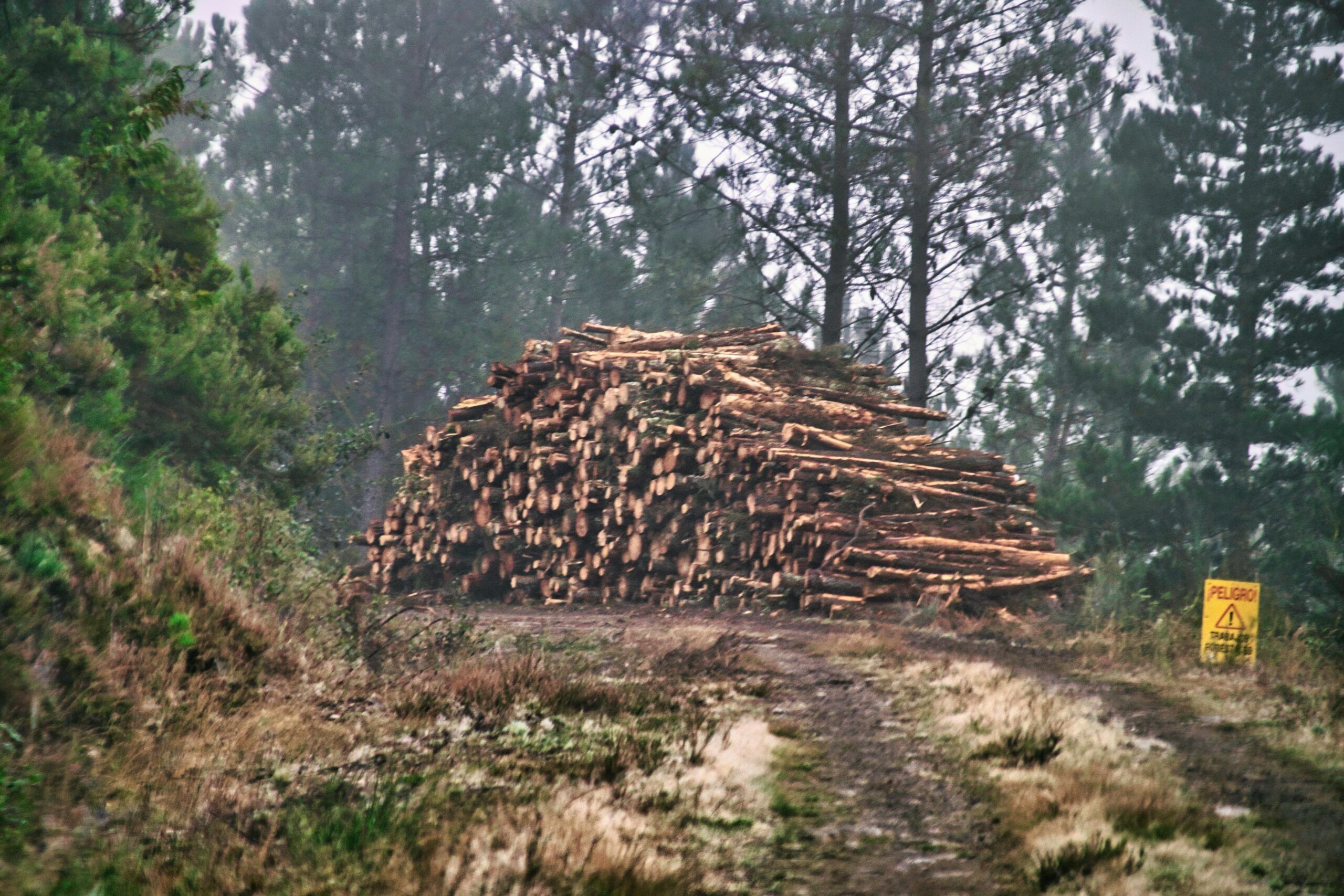
Illegal deforestation isn’t just a conservation issue anymore – it’s now tightly linked to how businesses operate across borders. With the EU Deforestation Regulation (EUDR) in force and more pressure globally for land-use transparency, companies can’t afford to treat forest monitoring as a side project. Tools that track land clearing, flag risk, and provide proof of legality are becoming core parts of supply chain compliance.
Below are a few organizations that have stepped up with solutions – some technical, some community-based – all focused on tackling illegal deforestation from different angles.
1. EUDR
EUDR.co provides consultancy services to guide companies in meeting EU Deforestation Regulation compliance requirements, focusing on supply chain risk mapping and due diligence preparation, but does not offer monitoring tools or data. Our role is centered on helping businesses understand, prepare for, and adapt to the legal requirements that now govern how deforestation-linked commodities are handled within the EU market. For organizations dealing with imports of coffee, cocoa, wood, soy, and similar products, clarity around what counts as “illegal deforestation” is not just important – it’s now a legal necessity.
We assist teams in mapping their supply chain risk, identifying data and documentation gaps, and preparing due diligence reports in line with the reversed burden of proof clause introduced by the EUDR. Our focus is on the actionable side of monitoring – making sure that once deforestation is detected or suspected, it’s escalated and documented properly. This makes our work tightly connected to illegal deforestation monitoring efforts, particularly when it comes to proving product legality.
Key Highlights:
- Helps clarify how EUDR defines illegal deforestation
- Supports supply chain documentation and traceability
- Prepares reports aligned with reversed burden of proof
- Focuses on high-risk commodity chains (e.g., soy, cocoa, wood)
Services:
- Regulatory support and EUDR advisory
- Supply chain risk mapping
- Due diligence report prep
- Document and data audit
- Guidance on handling suspected non-compliance
Contact Information:
- Website: eudr.co
- E-mail: info@eudr.com
- Address: Robert-Bosch-Str. 7, 64293 Darmstadt,Germany
- Phone: +49 6151 2776497
2. Satelligence
Satelligence brings radar satellite data into the deforestation conversation – especially in places where clouds make traditional imaging useless. They’re part of the RADD (Radar for Detecting Deforestation) initiative, which picks up disturbances in forest cover early, even in rainy or remote regions.
Their edge is in how they prioritize alerts. Instead of flooding teams with signals, they help focus attention where enforcement teams or NGOs can act fast. They started with scale-ups in Southeast Asia but now feed into broader systems like Global Forest Watch. Their work touches palm oil, soy, cocoa – anywhere land use change matters.
Key Highlights:
- Uses radar (Sentinel-1) for cloud-resistant monitoring
- Active in Southeast Asia, now scaling globally
- Helps prioritize alerts for field response
- Feeds data into GFW and similar systems
Services:
- Radar-based disturbance alerts
- Integration with Earth Engine and GFW
- Enforcement prioritization tools
- Forest monitoring system setup
Contact Information:
- Website: satelligence.com
- LinkedIn: www.linkedin.com/company/satelligence

3. ForestLink (Rainforest Foundation UK)
ForestLink takes a ground-up approach. Instead of relying solely on satellites, they equip local communities to report illegal clearing themselves – even from deep forest areas without a mobile signal. The alerts are sent by satellite, so enforcement teams can get real-time updates directly from the ground.
It’s a shift from top-down monitoring to something more decentralized and people-driven. Local knowledge adds context that satellite images can miss – like whether a clearing is legal or if land rights are being violated. ForestLink helps tie those local reports into systems that can actually act on them.
Key Highlights:
- Enables real-time alerts from remote forests
- Works even without mobile networks
- Strengthens community-authority connections
- Provides evidence from local observers
Services:
- Satellite-linked mobile app for forest alerts
- Community training and deployment
- Tools to document land rights violations
- Support for forest governance NGOs
Contact Information:
- Website: forestlink.org
- E-mail: info@rainforestuk.org
- Facebook: www.facebook.com/rainforestfoundationuk
- Twitter: x.com/RFUK
- Instagram: www.instagram.com/rainforestfoundationuk
- Address: Suite 201, Pill Box Studios, 115 Coventry Road, London E2 6GG, United Kingdom
- Phone: +44 (0) 20 7485 0193
4. Planet
Planet takes a high-frequency approach to satellite monitoring – we’re talking near-daily imagery, which makes it a solid fit for tracking forest changes before they spiral into bigger issues. Their satellites catch illegal clearing, degradation, and other land use shifts that might slip past lower-resolution tools, especially across wide or remote areas.
They also bring historic imagery into the mix, so it’s easier to compare today’s disturbances against past baselines. That’s especially useful when you’re dealing with verification tasks like REDD+, MRV, or compliance reporting. For anyone working in enforcement or land management, the regularity and resolution of Planet’s data can speed up detection and help catch violations while they’re still actionable.
Key Highlights:
- Near-daily satellite coverage with high resolution
- Helps spot forest clearing early – even in large areas
- Archive imagery supports baseline comparisons
- Used in REDD+ and MRV programs
- Fits public and private sector monitoring needs
Services:
- PlanetScope and SkySat imagery for land change detection
- Forest health and vegetation analytics
- Basemaps for regulatory and operational use
- API integration with forest platforms
Contact Information:
- Website: www.planet.com
- E-mail: press@planet.com
- Facebook: www.facebook.com/PlanetLabs
- Twitter: x.com/planet
- LinkedIn: www.linkedin.com/company/planet-labs
- Instagram: www.instagram.com/planetlabs
- Address: 645 Harrison Street, 4th Floor, San Francisco, CA 94107

5. ICEYE
ICEYE brings something a bit different to the table: radar satellites. These work no matter the weather, time of day, or cloud cover – which makes them especially useful in tropical forests or during rainy seasons when optical images just can’t cut it. Their SAR (Synthetic Aperture Radar) tech tracks even small shifts in land use, like roads being cut or forests cleared without permits.
For compliance teams, the advantage here is in how reliable the data is. If you need visibility over deforestation risk zones or want to verify whether land use changes match legal boundaries, ICEYE’s radar feed can support those checks. It’s not just about spotting activity – it’s about backing it with hard data that holds up when you’re questioned about legality.
Key Highlights:
- All-weather, day-and-night forest monitoring with radar
- Enables daily updates from the same position
- Useful for spotting illegal roads or clearing early
- Detects subtle changes in high-density forest
Services:
- SAR imaging coverage for forest zones
- Custom monitoring schedules based on risk
- Delivery of analysis-ready data
- Detection of illegal land conversion or infrastructure
Contact Information:
- Website: www.iceye.com
- Facebook: www.facebook.com/iceye
- Twitter: x.com/iceye_global
- LinkedIn: www.linkedin.com/company/iceye
- Address: Maarintie 6, 02150 Espoo, Finland
6. Swift Geospatial
Swift Geospatial blends satellite imagery with GIS tech to track deforestation in real time – with a strong emphasis on flagging illegal activity like logging, encroachment, or plantation expansion. They’ve built tools that not only detect changes but help contextualize them, which is important when you’re trying to prove legality or stay ahead of EUDR requirements.
Their services also go deeper into conservation planning. That includes forest inventory work, carbon stock estimation, and trend analysis – all relevant when you’re mapping out impact or preparing evidence for sustainable sourcing. It’s especially relevant for high-risk commodities like cocoa, palm oil, and timber, where land use monitoring isn’t just best practice – it’s becoming law.
Key Highlights:
- Real-time deforestation alerts through GIS
- Targets illegal logging, encroachment, and land conversion
- Includes mapping for biomass and carbon data
- Built with EUDR-aligned commodity sectors in mind
Services:
- Satellite monitoring for illegal activity
- High-resolution forest cover change maps
- Dashboards for compliance tracking
- Carbon stock and biomass estimation
Contact Information:
- Website: swiftgeospatial.solutions
- E-mail: info@swiftgeospatial.solutions
- Facebook: www.facebook.com/swiftgeospatial
- LinkedIn: www.linkedin.com/company/swift-geospatial
- Instagram: www.instagram.com/swiftgeospatial
- Address: CSIR, Building 4, 1st Floor, Meiring Naudé Rd, Brummeria, Pretoria, 0184
- Phone: +27 12 756 4950
7. CollectiveCrunch
CollectiveCrunch combines AI with remote sensing data, including SAR and satellite imagery, to monitor forests with minimal boots on the ground. Their platform flags clear-cutting, storm damage, and pest outbreaks in near real time, which is helpful when you’re trying to keep tabs on large or hard-to-reach forest assets.
They also track forest trends over time, making it easier to evaluate health, detect unpermitted activity, or just stay updated for reporting purposes. For supply chains tied to forest commodities – and especially those under EUDR pressure – this kind of visibility helps prove that sourcing isn’t linked to recent deforestation or illegal clearing.
Key Highlights:
- AI-driven platform for monitoring remote forests
- Near real-time detection of disturbances
- Flags illegal logging, storm damage, and pests
Services:
- Automated alerts for forest change
- Forest health monitoring and analytics
- Event-based inventory updates
- Time series trend and risk analysis
Contact Information:
- Website: www.collectivecrunch.com
- E-mail: info@collectivecrunch.com
- LinkedIn: www.linkedin.com/company/collectivecrunch
- Address: Keilaranta 6, 02150 Espoo VAT
8. Nadar
Nadar’s platform helps companies keep tabs on forest conditions using satellite data combined with machine learning. Whether it’s deforestation signals, carbon stock tracking, or mapping land use change, their tools are built to support real-world regulatory needs – especially for teams working through EUDR compliance.
They offer both a user-facing dashboard and integration-ready APIs, so you can plug their system into your own workflows. What makes them useful in this space is how they break down forest data into actionable insights for due diligence and traceability – particularly for companies sourcing cocoa, rubber, timber, or other forest-risk commodities.
Key Highlights:
- Tracks deforestation and carbon metrics via satellite
- Designed for use across tropical, temperate, and boreal forests
- Built with EUDR compliance and due diligence in mind
- Provides sourcing risk visibility and traceability support
Services:
- Satellite-based forest and land monitoring
- Digital MRV for carbon stock reporting
- Tools to validate deforestation-free sourcing
- Compliance dashboard tailored to EUDR workflows
Contact Information:
- Website: www.nadar.earth
- E-mail: info@nadar.earth
- LinkedIn: www.linkedin.com/company/nadar-earth
9. Aidenvironment
Aidenvironment isn’t a tech platform in the usual sense – they run a real-time monitoring program that mixes satellite data with investigative research to flag illegal deforestation and link it back to specific supply chain actors. Their reports often end up in the hands of civil society groups, journalists, or regulators looking to hold companies accountable.
Their focus is on transparency and public pressure. Whether it’s cattle grazing, soy farming, or palm oil production, they trace land clearing events to the companies behind them and bring that information into the open. It’s a different model – less about dashboards, more about impact. That makes them highly relevant in governance, due diligence, and NGO-driven accountability work.
Key Highlights:
- Connects deforestation alerts to commodity-linked companies
- Used by advocacy and media to drive accountability
- Documents forest loss linked to soy, palm oil, and cattle
- Supports forest governance and public disclosure efforts
Services:
- Satellite and field data tracking of land clearing events
- Actor mapping across commodity supply chains
- Reports for civil society campaigns and investigations
- Custom datasets for compliance or media use
Contact Information:
- Website: aidenvironment.org
- E-mail: eastafrica@aidenvironment.org
- LinkedIn: www.linkedin.com/company/aidenvironment
- Instagram: www.instagram.com/aidenvironment
- Address: Plot 99 Luthuli Avenue, Kampala, Uganda
- Phone: +256 (0)393 20 88 17
10. Omdena
Omdena works at the intersection of AI and forest monitoring. Instead of offering a fixed platform, they build custom machine learning models that process satellite and geospatial data to detect illegal logging, track land use shifts, and even recommend reforestation strategies based on environmental conditions.
Their tools are lightweight, flexible, and often built in collaboration with local stakeholders. That makes them a solid fit for early-stage innovation projects or policy planning where speed and adaptability matter. While Omdena isn’t a monitoring agency, their models can plug into larger forest protection efforts or support due diligence workflows under frameworks like the EUDR.
Key Highlights:
- Uses AI to flag deforestation and predict future risk
- Custom models trained on satellite and spatial data
- Detects early signs of illegal land use
- Recommends reforestation zones based on site analysis
Services:
- Satellite image analysis for real-time monitoring
- AI-based modeling of deforestation drivers
- Detection of illegal activity signatures
- Reforestation site selection and monitoring tools
Contact Information:
- Website: www.omdena.com
- Facebook: www.facebook.com/OmdenaAI
- Twitter: x.com/OmdenaAI
- LinkedIn: www.linkedin.com/company/omdena
- Instagram: www.instagram.com/omdenaglobal
11. Farmforce
Farmforce helps companies get traceability right from the very first step – the farm. Their tools are built for smallholder-heavy supply chains like cocoa, coffee, and palm oil, where field data can be fragmented or outdated. Using satellite imagery and mobile-based field verification, they make it possible to link harvests to mapped plots and confirm that sourcing isn’t coming from recently deforested land.
Their framework, which they call Integrated Enterprise Deforestation Monitoring, blends field mapping, quality control, and audit-ready documentation. It’s especially useful for businesses working across diverse regions that need to prove compliance under regulations like the EUDR without reinventing their whole workflow. Less manual data entry. More confidence in your records.
Key Highlights:
- Connects crop origin to verified, deforestation-free fields
- Supports traceability for smallholders in early supply chains
- Combines satellite data with mobile field validation
- Designed with EUDR due diligence in mind
Services:
- Field mapping and validation using satellite and mobile tools
- Traceability from farm to supply chain entry point
- EUDR-aligned compliance data prep
- Field-level quality assessments and reporting
Contact Information:
- Website: farmforce.com
- E-mail: info@farmforce.com
- LinkedIn: www.linkedin.com/company/farmforce
- Address: Tordenskiolds gate 2, 0160 Oslo, Norway
12. Global Forest Watch
Global Forest Watch (GFW) makes forest data open and accessible – full stop. Their platform lets anyone, from governments to journalists to compliance teams, view deforestation alerts almost in real time. It brings together radar, satellite imagery, and custom datasets from around the world, wrapped into one easy-to-navigate interface.
While GFW wasn’t built specifically for EUDR compliance, it’s widely used as a supporting tool for environmental risk checks. Teams can compare historical baselines, overlay sourcing regions, and export data for internal reporting or public disclosures. It won’t write your due diligence report for you, but it’ll absolutely help flag the areas that deserve a closer look.
Key Highlights:
- Global forest change platform with public access
- Tracks deforestation in near real time using radar and satellite data
- Used by NGOs, researchers, and government agencies
- Supports open monitoring and environmental transparency
Services:
- Satellite-based deforestation tracking and mapping
- User-friendly dashboard with search and filter tools
- Exportable datasets by region and time
- Global-to-local forest change coverage
Contact Information:
- Website: www.globalforestwatch.org
- E-mail: Kaitlyn.Thayer@wri.org
- Facebook: www.facebook.com/globalforests
- Twitter: x.com/globalforests
- LinkedIn: www.linkedin.com/showcase/globalforestwatch
- Instagram: www.instagram.com/globalforests
13. Mighty Earth
Mighty Earth approaches deforestation differently. They’re not building platforms or compliance dashboards – they’re calling out bad actors. Through their Rapid Response program, Mighty Earth uses satellite imagery from sources like Global Forest Watch and supply chain data to identify fresh forest loss and name the companies involved. Think more watchdog than workflow tool.
Their goal is public accountability. If a palm oil supplier clears protected forest or a soy trader is linked to land grabs, Mighty Earth publishes the findings and pushes for action. While their reports aren’t regulatory filings, they add serious weight to the pressure landscape, especially when companies are trying to maintain deforestation-free sourcing claims under frameworks like the EUDR.
Key Highlights:
- Links deforestation to specific corporate actors in agriculture
- Covers palm oil, soy, beef, and cocoa supply chains
- Uses satellite imagery combined with supply chain tracing
- Focused on Latin America and West Africa
Services:
- Monthly monitoring of commodity-linked forest loss
- Rapid Response reports tied to corporate supply chains
- Public watchlists of environmental offenders
- Supply chain mapping for land use accountability
Contact Information:
- Website: mightyearth.org
- E-mail: inquiry@mightyearth.org
- Facebook: www.facebook.com/StandMighty
- LinkedIn: www.linkedin.com/company/mightyearth
- Instagram: www.instagram.com/standmighty
- Phone: (771) 772-3434
Conclusion
Deforestation monitoring has come a long way. What used to rely on occasional field reports or siloed satellite snapshots is now a network of tools – some open, some proprietary – all pushing toward one goal: eliminating blind spots in how land is used and sourced.
Regulations like the EUDR have made traceability a legal requirement, not a nice-to-have. And with that shift, the question isn’t whether tools exist – it’s whether companies are willing to use them properly. From field-level validation to public watchlists, each of the providers in this article adds a different piece to the puzzle. Some focus on compliance, others on visibility or pressure. But together, they’ve helped shrink the gap between deforestation happening and someone being held accountable for it.
For businesses operating in forest-risk supply chains, it’s no longer just about collecting data – it’s about proving you’ve done the work to act on it.