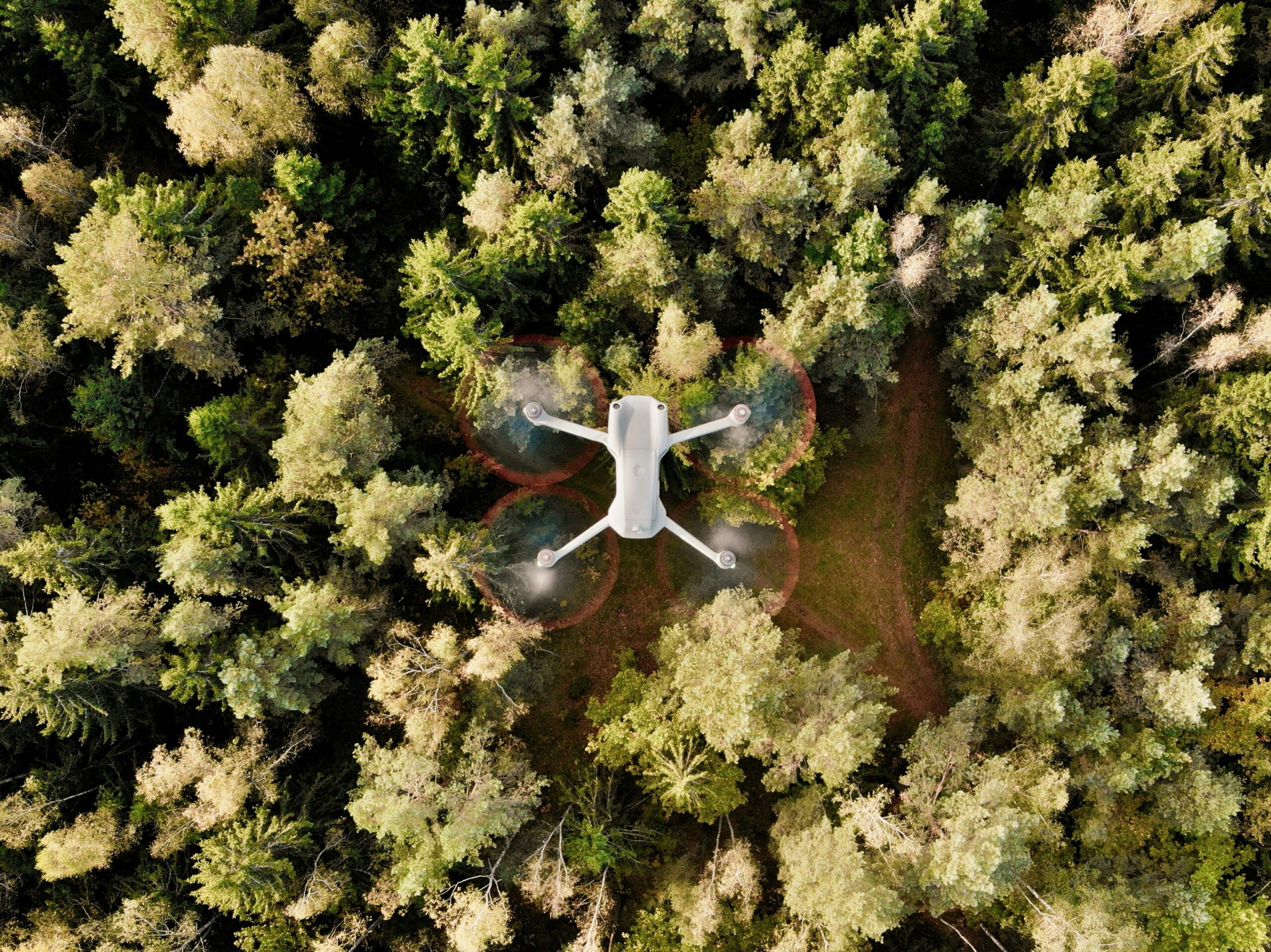
Getting forest monitoring right isn’t just about pulling up satellite images. It’s about making sure those images – and the data behind them – actually tell you something useful for compliance. Whether you’re trying to meet EUDR standards or just stay ahead of supply chain risk, you need tools that do more than show a map. You need ones that connect back to land use, traceability, and due diligence in a way that holds up when the questions come.
Below are a few platforms that can help – not just with imagery, but with turning that imagery into evidence. Some are open source, some are commercial, and all of them are actively being used to support forest-related monitoring in high-risk commodity supply chains.
1. EUDR
EUDR.co provides consultancy services to guide organizations on EUDR compliance, helping them understand how to apply monitoring tools, but does not directly collaborate with specific platforms listed. Our role is to make sure companies understand what’s expected under the regulation and how software can be used to build a defensible due diligence system. We help interpret how forestation data feeds into the compliance process – whether it’s through sourcing traceability, land-use confirmation, or generating evidence to avoid penalties.
Forestation monitoring software doesn’t replace legal understanding – it supports it. That’s where we come in. By aligning satellite-based monitoring, alert systems, and geolocation data with the obligations outlined in the regulation, we help companies close the gap between raw inputs and compliance-ready documentation. Our guidance helps teams connect tool outputs to real-world legal exposure under the EUDR.
Faits marquants :
- Satellite data is just one part of the compliance equation
- Support for due diligence structure and supplier-level data
- Experience with forest-risk commodities and workflows
- Work closely with software and legal advisory teams
Pour qui c'est le mieux :
- Compliance leads managing EUDR-regulated commodities
- Legal teams building defensible due diligence records
- Sustainability officers handling sourcing and land-use risk
Informations de contact :
- Site web : eudr.co
- E-mail : info@eudr.com
- Adresse : Robert-Bosch-Str. 7, 64293 Darmstadt,Allemagne
- Téléphone : +49 6151 2776497 +49 6151 2776497
2. EOSDA LandViewer
LandViewer is a browser-based tool from EOSDA that makes it easy to work with satellite imagery – even if you’re not a remote sensing expert. You can check forest health, detect burn zones, track land cover change, and filter by vegetation indices. Everything runs online, and there’s no complicated setup.
It’s not built as a full EUDR compliance system, but it’s useful for validation and early screening. You can spot areas of deforestation, look back at historical imagery, or monitor recovery after disturbance. It’s a solid fit for teams that need to understand forest conditions without building custom GIS stacks.
Faits marquants :
- Works in the browser with no need for advanced GIS
- Access to imagery from Sentinel, Landsat, and others
- Vegetation indices and burn mapping built-in
- Historical archive goes back to 1982
Pour qui c'est le mieux :
- Companies monitoring forest areas in their supply chain
- Forestry teams tracking canopy health
- Consultants helping clients prep for EUDR
Informations de contact :
- Site web : eos.com
- Courriel : sales@eosda.com
- Facebook : www.facebook.com/EOSDA
- Twitter : x.com/eos_da
- LinkedIn : www.linkedin.com/company/eos-data-analytics
- Instagram : www.instagram.com/eosdataanalytics
- Adresse : 800 W. El Camino Real, Suite 180, Mountain View, CA 94040 USA 800 W. El Camino Real, Suite 180, Mountain View, CA 94040 USA
3. Open Foris
Open Foris is a set of free, open-source tools for land and forest monitoring. It’s been used around the world for everything from national forest inventories to local reforestation tracking. If you’ve worked on UNFCCC reporting, you’ve probably seen it in action.
You get a mix of mobile apps for field data, platforms for visual analysis, and satellite imagery tools like SEPAL. It’s flexible, widely adopted, and doesn’t require huge technical teams to get started. For EUDR-aligned work, it helps link what’s happening on the ground to what’s visible from space – a key step in building out a real monitoring system.
Faits marquants :
- Modular, open-source tools for different monitoring tasks
- Strong fit for MRV systems and field-level data
- SEPAL platform for image processing without deep coding
- Supports forest restoration, land-use mapping, and more
Pour qui c'est le mieux :
- Public-sector teams building national forest inventories
- NGOs and nonprofits tracking restoration or deforestation
- Companies needing low-cost, adaptable monitoring tools
Informations de contact :
- Site web : openforis.org
- Facebook : www.facebook.com/OpenForis
- Twitter : x.com/OpenForis
- LinkedIn : www.linkedin.com/company/open-foris
4. Farmforce
Farmforce tackles one of the hardest parts of compliance: proving what’s going on in smallholder plots. Their platform is built around field-level mapping, traceability, and data checks – with a strong focus on what’s happening before the commodity even leaves the farm.
The system connects on-the-ground apps with satellite-based deforestation alerts from Global Forest Watch. You get structured workflows, supplier-level records, and a way to prove land use history. It’s especially useful in cocoa, palm, coffee, and other commodities where recent deforestation can derail entire shipments.
Faits marquants :
- Combines field mapping with satellite-based alerts
- Focuses on traceability and audit-quality data
- Built for regulated commodity supply chains
- Mobile apps support data collection and ground truthing
Pour qui c'est le mieux :
- Companies sourcing from fragmented, smallholder networks
- Sustainability teams preparing for EUDR inspections
- Traceability teams managing complex compliance data
Informations de contact :
- Site web : farmforce.com
- Courriel : info@farmforce.com
- LinkedIn : www.linkedin.com/company/farmforce
- Adresse : Tordenskiolds gate 2, 0160 Oslo, Norvège
5. Géospatial Swift
Swift Geospatial offers forest monitoring tools that rely on satellite imagery and GIS tech – and they’re built to spot problems fast. Whether it’s illegal logging, canopy loss, or land-use changes, their platform helps surface what’s happening on the ground, even when no one can get there physically.
The system is set up for industries like forestry, palm oil, and cocoa – the kinds of sectors where forest conversion risk is high and visibility is often low. You get real-time alerts, stress zone mapping, and layered imagery that makes it easier to track restoration progress or spot new disturbances. It’s not labeled as an EUDR compliance tool, but it can definitely support those workflows if you’re trying to validate a region or flag deforestation before it becomes a problem.
Faits marquants :
- Real-time forest cover tracking using satellite imagery
- Built-in GIS for spotting encroachment and logging events
- Tools for canopy stress and land-change analysis
- Supports reforestation monitoring with older imagery
Pour qui c'est le mieux :
- Companies sourcing from high-risk plantation zones
- NGOs or researchers watching forest degradation
- Compliance teams trying to verify land-use status
Informations de contact :
- Site web : swiftgeospatial.solutions
- Courriel : info@swiftgeospatial.solutions
- Facebook : www.facebook.com/swiftgeospatial
- LinkedIn : www.linkedin.com/company/swift-geospatial
- Instagram : www.instagram.com/swiftgeospatial
- Adresse : CSIR, Building 4, 1st Floor, Meiring Naudé Rd, Brummeria, Pretoria, 0184
- Téléphone : +27 12 756 4950 +27 12 756 4950
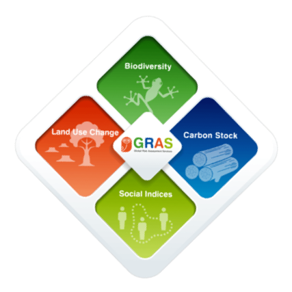
6. GRAS
GRAS is all about zero-deforestation – not just as a slogan, but as a measurable reality. Their platform helps companies figure out whether land has been cleared illegally, whether there’s risk tied to expansion crops, and if a plot meets EUDR-style requirements before sourcing ever starts.
They use satellite imagery paired with their own algorithms to flag what’s changed – from one season to the next or across years. GRAS also helps with certification prep. If you need pre-audit checks or deforestation timing analysis tied to specific fields, they’ve got that covered too. It’s especially helpful when you’re trying to verify whether a supplier’s land meets non-deforestation criteria before contracts are signed.
Faits marquants :
- Identifies land-use change down to individual plots
- Helps time deforestation events for audit prep
- Detects crop-driven land clearing patterns
- Uses layered satellite imagery with structured logic
Pour qui c'est le mieux :
- Procurement teams reviewing supplier locations
- Sustainability departments tracking forest commitments
- Companies building EUDR-ready documentation
Informations de contact :
- Site web : www.gras-system.org
- Courriel : info@gras-system.org
- Adresse : Hohenzollernring 72, D-50672 Köln
- Téléphone : +49-221- +49-221-50802030
7. Orbify
Orbify isn’t just focused on forests – it covers carbon, biodiversity, and land-use risk more broadly – but forest monitoring is baked into the platform. Their system is flexible: you can run automated workflows or get more hands-on with analyst-driven setups, depending on how deep you need to go.
What stands out is how Orbify ties monitoring back to real-world goals like carbon offsets or EUDR compliance. It can track land cover change, highlight deforestation zones, and generate layers for verification reports. If you’re managing impact across large regions or juggling different project types, this one’s designed to scale with you.
Faits marquants :
- Modular satellite platform for forests, carbon, and nature risk
- Tracks vegetation and deforestation patterns
- Assesses baseline areas and leakage zones
- Used for both supply chain and offset project audits
Pour qui c'est le mieux :
- Carbon project developers needing land-use proof
- Compliance teams tracking supplier regions
- Companies managing environmental risk across sites
Informations de contact :
- Site web : orbify.com
- Twitter : x.com/OrbifyInc
- LinkedIn : www.linkedin.com/company/orbify
- Téléphone : +44 7401 495 390 +44 7401 495 390

8. APP Forest Alert Service (MDA)
APP’s Forest Alert Service, powered by MDA, uses satellite-based monitoring to track forest cover changes, effective in cloudy or remote areas, though specific satellite sources are not specified. It’s used to watch over concession areas and flag anything that looks like logging, encroachment, or storm damage.
The updates come every few weeks and can be tied into local patrols or community interventions. While it’s tailored for APP’s own operations, it’s a good example of how satellite alert systems can be embedded into day-to-day forest management – not just as a report generator, but as a live governance tool.
Faits marquants :
- Radar imaging sees through clouds and at night
- Tracks forest damage from logging, weather, and encroachment
- Delivers frequent alerts for patrol follow-up
- Works in hard-to-access conservation zones
Pour qui c'est le mieux :
- Forest operators managing large remote areas
- Teams combining satellite alerts with on-ground patrols
- Stakeholders overseeing high-conservation-value zones
Informations de contact :
- Site Web : sustainability-dashboard.com
- LinkedIn : www.linkedin.com/company/appgroupid
- Instagram : www.instagram.com/asiapulppaper
9. Omdena AI pour la déforestation
Omdena doesn’t sell plug-and-play tool. Instead, they co-build custom AI models with partners who are trying to tackle very specific deforestation risks. Maybe it’s tracking new roads that could open up illegal logging. Maybe it’s projecting where forest loss might happen next. Whatever the use case, they lean into flexibility – designing models that fit local data, terrain, and challenges.
It’s more of a collaborative process than a traditional platform. That means NGOs, researchers, or governments working with Omdena get something tuned to their exact needs – not just a dashboard with pre-set layers. They also help with reforestation workflows, like figuring out where planting would work best or keeping tabs on restoration progress over time.
Faits marquants :
- Custom AI models for near real-time forest alerts
- Predictive tools for spotting high-risk areas early
- Can track road expansion and clearing patterns
- Co-designed with partners based on local data
Pour qui c'est le mieux :
- Teams designing their own forest monitoring solutions
- NGOs looking to map drivers of deforestation
- Organizations needing flexible AI tools for early warning
Informations de contact :
- Site web : www.omdena.com
- Facebook : www.facebook.com/OmdenaAI
- Twitter : x.com/OmdenaAI
- LinkedIn : www.linkedin.com/company/omdena
- Instagram : www.instagram.com/omdenaglobal
10. CollectiveCrunch
CollectiveCrunch combines satellite, radar, and AI to keep an eye on forests – from harvest zones to storm damage. Their system flags changes quickly, whether it’s clear-cutting, pest outbreaks, or just slow degradation over time. The idea is to reduce the need for constant field checks and give forest managers real-time insight without losing accuracy.
It’s mainly used in commercial forestry, but the tech works just as well for anyone tracking forest health over large areas. You get regular updates, time series data, and tools to spot issues before they snowball. It’s built for scale, so whether you’re managing a few hundred hectares or an entire region, it adjusts.
Faits marquants :
- Real-time monitoring of harvesting, damage, and degradation
- Pulls in satellite, radar, and LiDAR data for better accuracy
- Detects storm impacts, pests, and other stressors
- Time series data for planning and forest asset reports
Pour qui c'est le mieux :
- Forestry companies managing large assets
- Landowners seeking automated event detection
- Teams monitoring operational risks in real time
Informations de contact :
- Site web : www.collectivecrunch.com
- Courriel : info@collectivecrunch.com
- LinkedIn : www.linkedin.com/company/collectivecrunch
- Adresse : Keilaranta 6, 02150 Espoo TVA
11. CyberSWIFT
CyberSWIFT focuses on using GIS and satellite tools to map out forest cover – and figure out what should grow where. They combine remote sensing with mobile field apps, so you’re not just looking at imagery; you’re verifying it with ground truth. Their tools can be used to flag deforested zones, pick reforestation spots, and assess environmental conditions like soil type and slope.
They also offer offline-capable mobile data collection, which helps in regions where internet access is hit-or-miss. The approach blends high-res imagery with practical field data, which makes it useful for government-led programs or forestry teams that need to classify land use in detail and keep restoration efforts on track.
Faits marquants :
- Classifies land for afforestation or deforestation zones
- Connects satellite imagery with mobile field data
- Offline support for data collection in remote areas
- Assesses environmental conditions like soil and slope
Pour qui c'est le mieux :
- Government agencies running afforestation programs
- Orgs mapping degraded land for replanting
- Forestry teams combining remote sensing with field surveys
Informations de contact :
- Website: www.cyberswift.com
- E-mail: info@cyberswift.com
- Facebook: www.facebook.com/meetcyberswift
- Twitter: x.com/meetcyberswift
- LinkedIn: www.linkedin.com/company/cyber-swift
- Address: DN 52, PS Srijan Tech Park, 6th Floor, Salt Lake, Sector-V, Kolkata – 700091
- Phone: +9198833-22994
12. MapMyCrop Forest Monitoring Platform
MapMyCrop’s forest monitoring tool is built to help track what’s happening to vegetation over time – whether that’s logging, fire, or gradual canopy loss. It uses satellite imagery from multiple sources and layers it into a clean map view where you can check for disturbance events, compare change across seasons, or just keep tabs on overall forest health.
It’s mostly geared toward resource management, but it’s also handy for early compliance work. If your team needs visual proof of deforestation-free sourcing – or you’re starting to map out restoration – this platform can help create that baseline. You can set up monitoring intervals, spot trends, and get map-based outputs that are easy to share and document.
Faits marquants :
- Detects forest change from logging, fire, or harvesting
- Pulls in satellite data from multiple imagery sources
- Tracks canopy and vegetation trends over time
- Visual outputs for internal validation or reporting
Pour qui c'est le mieux :
- Operational teams managing working forests
- Analysts monitoring canopy condition trends
- Organizations creating visual land-use documentation
Informations de contact :
- Website: mapmycrop.com
- E-mail: info@mapmycrop.com
- Facebook: www.facebook.com/mapmycrop
- Twitter: x.com/mapmycrop
- LinkedIn: www.linkedin.com/company/map-my-crop
- Instagram: www.instagram.com/mapmycrop
- Address: One World Trade Center Suite 8500 New York, NY, 10007 USA
- Phone: +1-917-414-3909
13. EO at DHI (Forest Monitoring)
EO at DHI takes a broad approach to forest monitoring. Their platform combines consistent satellite coverage with remote sensing to help track changes in forest area – from slow degradation to more sudden losses due to fire or logging. It’s built for large-scale land projects and is already being used in public, NGO, and private-sector monitoring efforts.
The system doesn’t handle compliance paperwork on its own, but it supports the kind of consistent data collection and land-change tracking that’s often needed when documenting sourcing regions. For teams working with EUDR or similar frameworks, it provides a solid starting point for due diligence or early-stage risk reviews.
Faits marquants :
- Identifies forest loss, degradation, and landscape change
- Works at scale – across regions or entire concessions
- Outputs can support reporting, planning, or early alerts
- Often used in environmental and public-sector land projects
- Can be paired with field validation for due diligence
Pour qui c'est le mieux :
- Environmental teams monitoring forest stress over time
- Projects needing reliable, large-area baseline mapping
- Companies tracking land-use change in regulated areas
Informations de contact :
- Website: eo.dhigroup.com
- E-mail: gras@dhigroup.com
- Twitter: x.com/dhigroup
- LinkedIn: www.linkedin.com/company/dhi
- Address: Agern Alle 5, 2970 Hørsholm, Denmark
- Phone: +45 4516 9100
14. Remote Sensing Solutions (RSS)
RSS provides advanced forest monitoring using radar, optical imagery, and AI to track deforestation, degradation, carbon stock changes, and biomass loss, tailored for REDD+ and carbon projects. If you’re working in REDD+ or carbon markets, this platform is built to help with baseline assessments, MRV workflows, and longer-term forest structure tracking.
It’s not just about mapping what’s been lost. RSS also helps analyze canopy density, detect fire impact, and map tree species variation using time series and modeling tools. If carbon accounting is part of your mandate – or you need spatial depth to support restoration goals – this is one of the more technically robust options out there.
Faits marquants :
- Built for REDD+, MRV, and voluntary carbon projects
- Estimates carbon stock and biomass over time
- Detects forest degradation and fire impacts
Pour qui c'est le mieux :
- Carbon project teams using verified methodologies
- Forestry orgs running long-term degradation assessments
- Groups tracking aboveground biomass loss over time
Informations de contact :
- Website: www.remote-sensing-solutions.com
- E-mail: info@rssgmbh.de
- LinkedIn: www.linkedin.com/company/remote-sensing-solutions-gmbh
- Address: Landsberger Str. 314, 80687 Munich
- Phone: +49(0)89 48954765
Conclusion
There’s no single way to monitor forest change – and honestly, that’s a good thing. Different tools handle different layers of the problem. Some are focused on live alerts or predictive modeling. Others lean into satellite-based mapping, carbon measurement, or visual validation. Together, they help fill the gap between raw data and something that actually stands up to legal or supply chain scrutiny.
As frameworks like the EU Deforestation Regulation come into effect, having the right kind of monitoring matters more than ever. It’s not just about collecting imagery – it’s about proving that what’s visible lines up with what’s required. And that takes more than screenshots. Whether you’re working on sourcing validation, restoration tracking, or long-term compliance, these platforms can help – but picking the right one means knowing exactly what you need to show, and to whom, and how often.